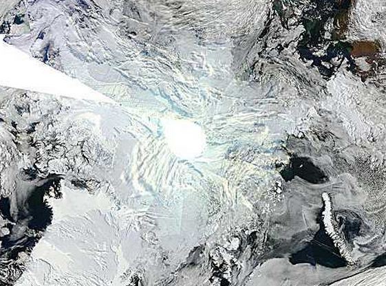
As the Sun sets over the pole for the winter, satellites can no longer photograph it with visible light. Note the circular hole in the center of today’s image.
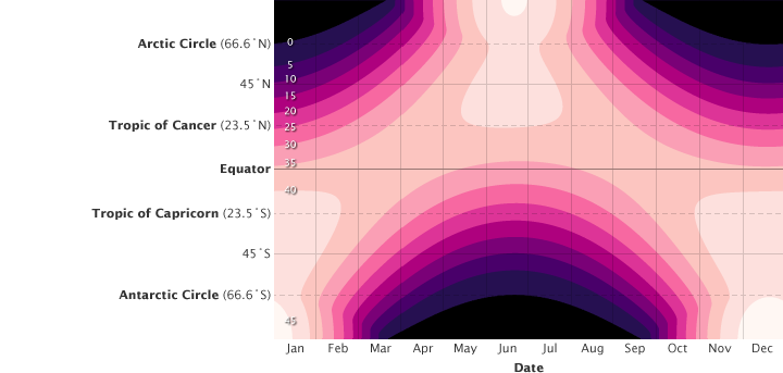
The hole will spread quickly to lower latitudes over the next few weeks, while the sun begins to rise at the South Pole. The chart below shows solar energy received by date and latitude.
 ‘http://earthobservatory.nasa.gov/Features/EnergyBalance/page3.php
Note that the South Pole receives more solar energy during the year than the North Pole, because the earth is closest to the Sun during the Southern Hemisphere summer.


Isn’t that circle due to something else though? There’s one on this as well
http://arctic.atmos.uiuc.edu/cryosphere/NEWIMAGES/arctic.seaice.color.000.png
which doesn’t use visible light.
Andy
Here is the same visible image from a week ago. No hole
http://exploreourpla.net/explorer/?map=Arc&sat=ter&lvl=4&lat=89.000000&lon=0.000000&yir=2010&dag=253
The microwave satellites have other limitations at high latitudes.
But doesn’t the sun sink below the horizon at the equinox which is not quite yet?
There seems to be no lessening of brightness towards the poles when that image was taken, also the perfect circle seems to indicate something else than approaching darkness.
Andy
The hole is a little bigger today, as the sun sets.
http://exploreourpla.net/explorer/?map=Arc&sat=ter&lvl=4&lat=89.000000&lon=0.000000&yir=2010&dag=262
Opposite happens in Antarctica:
http://exploreourpla.net/explorer/?map=Ant&sat=ter&lvl=5&lat=-89&lon=0