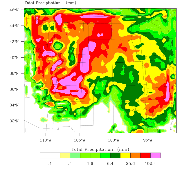
I’ve been running NCAR’s WRF weather model (using GFS boundary conditions) for the last few weeks, and comparing vs commercial forecasts. WRF has been doing considerably better than the standard Internet forecast sites.
For example, I generated this eight day precipitation forecast three days ago and was surprised by the very large amounts of rain being predicted in Colorado and northern New Mexico.
Sure enough, it has been spot on – we have gotten nearly a quarter of our normal annual rainfall in just a few days, with no end in site for three more days.


I see everything completely clearly now:
mhttp://oi56.tinypic.com/294t7vc.jpg
I see everything completely clearly now:
http://oi56.tinypic.com/294t7vc.jpg
Eight days is a bit too much for the initial and boundary conditions (GFS). I wouldn’t trust it beyond 5 days.
This map is also WRF, only 3 days, but it also shows quite a lot of precipitation there: http://www.meteoexploration.com/snow/snowmapsUS.html (For precipitation click on the right side, above)