http://www.hprcc.unl.edu/products/maps/acis/WaterTDeptUS.png
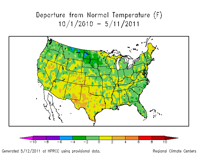
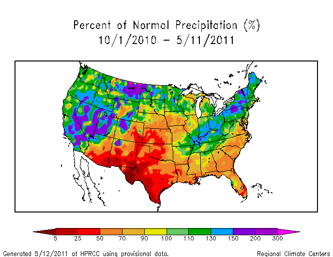
Since the start of the water year (October 1) temperatures along the Mississippi River drainage have generally ranged from 0 to 8 degrees below normal. The largest precipitation anomalies (image below) have occurred in regions which were also the coldest – North Dakota eastern Montana, Minnesota, Ohio, Michigan, Indiana, etc. By contrast, Texas was warm and dry.
http://www.hprcc.unl.edu/products/maps/acis/WaterPNormUS.png


The Mississippi floods were due to a strong frontal boundary that kept setting up repeatedly in the same area. What that has to do with global warming/climate change is beyond comprehension.
1927 Mississippi floods compared
http://www.weatherbell.com/jd/?p=1439