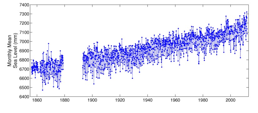
Tide gauges show that sea level in Manhattan is rising about 4mm per year and accelerating.
Data and Station Information for NEW YORK ( THE BATTERY)
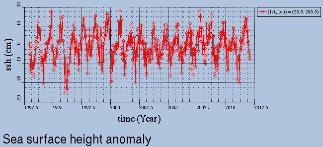
But satellite data shows little sea level rise at that same location, and has been flat since 1998.
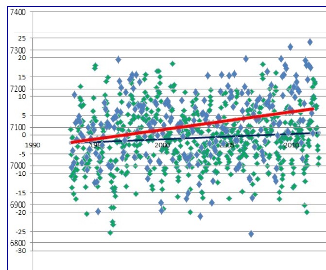
The graph below superimposes the data from the two graphs above. Essentially all of the claimed “sea level rise” (red line) is actually subsidence.
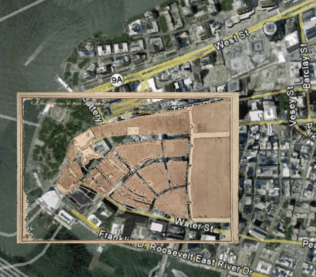
The map below superimposes lower Manhattan in 1660 on modern day lower Manhattan. Most of the land in modern lower Manhattan is fill dirt. The tide gauge is locate on fill and is subsiding.
Global warming geniuses in government tell us that we can stop subsidence by buying a hybrid or imposing a tax.


A widely reported tide gauge in Atlantic City sits on top of ground subsiding as the result of over drafting groundwater
Just recently we had some fool that claimed all the tide gauges were only placed on solid footing to insure subsistence is not a factor.
Just goes to show how little the issue has been researched by the so called professionals.
So why don’t you also draw a map of lands adjacent to New York Harbor showing which areas are rising still from post-glacial rebound, ( Central Park is heavily scored with glacial grooves) which are slumping as landfills compact and Victorian pilings fail, and which exhibit deflation from centuries of water extraction ?