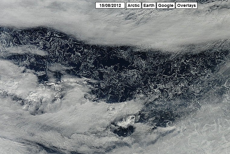
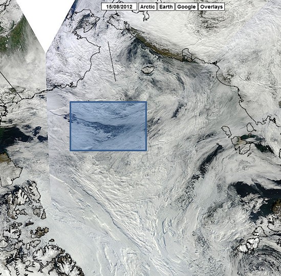
The clouds are finally clearing after last week’s Arctic storm, and now we can see the large regions of supposedly ice free water which opened up.
//ARCTIC.IO/OBSERVATIONS/8/2012-08-15/8-N76.720116-W157.095889
We now have a new category of ice-free water, which would have in past times been described as full of dangerous ice. They desperately need a record minimum, even it means not seeing a few Texas sized regions of ice.


Yeah, the Canadian Ice Service has the most accurate concentration levels. Where everyone else shows nothing, they show ice.
Two buoys NE of Greenland showing below freezing temps. They have webcams, too.
http://obuoy.datatransport.org/monitor#overview/gpstracks
I like to check on this site for the other buoys, as well. Temps close to your highlighted area are at or below freezing.
http://iabp.apl.washington.edu/maps_daily_map.html
In my opinion, the next several years, the arctic will probably continue to have relatively low sea ice in the summer, (at least compared to the 1970s and 80s) until the AMO cools towards the end of the decade. When we do see both the pacific and atlantic in their cold states like we did in the 60s and 70s, sea ice should recover in the arctic. Also, if we are going to have a strong summer for sea ice, usually the winter MEAN TEMPS north of the 80th parallel needs to drop to -30F or lower. (look at DMI) Many years in the 1960s, 1970s, and 1980s were able to do this, and sea ice was stable in the arctic but the late 90s and 00s have struggled to get the mean temperature down to this level, thus sea ice has declined. However, other factors such as the recent arctic storm and wind patterns have played a large role in the decline in sea ice as well. Despite the drop in ice over the Arctic, the Antarctic has seen an appreciable increase in ice, thus any sea level rise from the melting arctic ice cap is balanced out by the freezing in the southern cap.
Eric, Thank you for the interesting post. I wonder if Joe Bastardi has ever done an Arctic forecast, incorporating the AMO?
However, I hope you’re not talking about sea ice when you say “any sea level rise from the melting arctic ice cap”. We don’t want to revisit Archimedes Principle yet again.
If I’m correct, he believes it is AMO and PDO related as well, not 100% on that. Well, in the statement at the end, I was deterring the warmist argument that increasing sea level rise is because of ice cap melting over the north pole, when the south pole is gaining ice, so the effect from melting isn’t way or the other, plus sea level rise has been rising at a linear rate since record keeping began.
also note that several of the SST maps have an anomolous Hot Spot on the Alaskan Coast. It looks like the mapping software failed to screen out a bouy temperature that’s gone bad.
Yeah, the waters off of Alaska are below normal, good reason why there was so much ice last winter.
I’m talking about this. The local red spot on the coast that suggests the water temp is around 22-24 C !! Really?? >70 F water on the arctic coast?
http://polar.ncep.noaa.gov/sst/ophi/color_sst_NPS_ophi0.png
Though, I misspoke about the locale. Looking closer, I think that’s east of Alaska, part of the Canadian Coastline.
It’s the neighborhood of the Mackenzie delta. Considering average summer water surface temperatures there were ~16-17 degrees in 1974, a few degrees higher today doesn’t seem like a stretch.
http://www.restco.ca/BSPTR/BSP_TR15_Davies.pdf
(you want page 17 of that PDF). Here’s another one showing summer water temperatures of 19+ degrees C.
http://www.mackenziegasproject.com/theProject/regulatoryProcess/applicationSubmission/Documents/MGP_EIS_Vol3_%20Part_B_Section_6_S.pdf
(page 6-39)
Peter;
Thanks for the references. I looked but could not find any current water temp measurements. The 1974 PDF indicates a peak in July. The other reference just notes a summer max. I can understand why the river delta will have warmer, fresh water. I just don’t see why the water temp would be on average so much higher. An 8 – 9 C jump looks bogus. Like the red and orange airport tarmac temperatures that stand out as outliers in the air temp maps. Is there a string of water temps that indicate that its real?
Compare the the Russians sea ice map to the CT extent and concentrations.
http://www.aari.ru/odata/_d0015.php?lang=1&mod=0&yy=2012
This is just cheating and I am not going to take any notice of their self proclaimed correct predictions anymore.The ice boundary may be a bit slushy but it has been every year recently and the extent on the pacific side is greater than it has been, I can see from the IMS maps that the boundary is not solid it is constantly changing which is to be expected at this time of year.How can they make this sort of ice disappear this year but retain in it previous years.