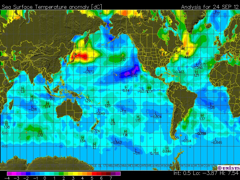
The UK Met Office predicted that half of the years between 2011 and 2015 would be the hottest on record, but with El Nino collapsing – their divide an odd number by two error is pretty much doomed.
Disrupting the Borg is expensive and time consuming!
Google Search
-
Recent Posts
- Analyzing The Western Water Crisis
- Gaslighting 1924
- “Why Do You Resist?”
- Climate Attribution Model
- Fact Checking NASA
- Fact Checking Grok
- Fact Checking The New York Times
- New Visitech Features
- Ice-Free Arctic By 2014
- Debt-Free US Treasury Forecast
- Analyzing Big City Crime (Part 2)
- Analyzing Big City Crime
- UK Migration Caused By Global Warming
- Climate Attribution In Greece
- “Brown: ’50 days to save world'”
- The Catastrophic Influence of Bovine Methane Emissions on Extraterrestrial Climate Patterns
- Posting On X
- Seventeen Years Of Fun
- The Importance Of Good Tools
- Temperature Shifts At Blue Hill, MA
- CO2²
- Time Of Observation Bias
- Climate Scamming For Profit
- Climate Scamming For Profit
- Back To The Future
Recent Comments
- Bob G on Analyzing The Western Water Crisis
- arn on Analyzing The Western Water Crisis
- Bob G on Analyzing The Western Water Crisis
- Bob G on Analyzing The Western Water Crisis
- Bob G on Analyzing The Western Water Crisis
- Hank Phillips on Analyzing The Western Water Crisis
- Hank Phillips on Analyzing The Western Water Crisis
- Hank Phillips on Analyzing The Western Water Crisis
- Hank Phillips on Analyzing The Western Water Crisis
- Bob G on Analyzing The Western Water Crisis


Wait for a redefinition of El Nino.
El Nino was apparently stillborn.
And SkS think next year will be the hottest ever….unless La Nina’s have mutated into heating the planet it isn’t going to happen.
adjustments will get them there…who needs reality
I was wondering when Steve was going to post this image.
IIRC, 1998 is still the record high for RSS and HADCRUT, right? So we’re essentially guaranteed 14 years without a new record high, and if the El Nino goes away like it appears to be, 2013 will be year number 15. Honestly, it’d probably take a decent El Nino in ’14 or ’15 to break the “record”…it sure would be funny if none of the 2011-15 years broke the record when “half” were supposed to. At what point does the general population wake up? When the record hits 15 years? 20? 25? 30!?!? I’m already working with new grad students who obsess over CAGW and don’t realize that there hasn’t been any measured warming since they were 8 years old (and if you adjust for Pinatubo, probably no statistically significant warming since they were born). Why aren’t these numbers being spoken by skeptics more often?
-Scott
Even GISS data has recently failed the 95% certainty test for the IPCC prediction of .2C per decade. Which means models, statistically speaking, have less than 5% chance of still being correct. That is normally the point at which a hypothesis is categorically rejected. Don’t hold your breath waiting for a press release from RC.
That’s an interesting image.
I live in northern Japan. Our winter weather pattern is dominated by the by the static central Siberian high feeding an arctic north-westerly air stream into Pacific low pressure systems to the east of Japan. That air stream has to cross about 1000km of the Sea of Japan before it gets to my home. The result is a mega lake-effect.
Last winter we had 16+ metres of snowfall in town, meaning about 3 hours per day for 3 months keeping our shop and parking snow-free. Not looking good for this winter. Bwah-ha!