
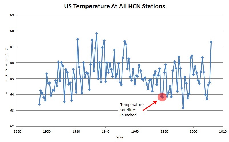
Satellites went up at the end of the ice age scare during one of the coldest years ever, and temperatures were further dragged down by two large volcanic eruptions in the early 1980s and 1990s.
You can’t draw many meaningful conclusions from the satellite record prior to 1996.

There will be no meaningful conclusion from satellite records for at least another 150 years! The record is way to short to have any meaning. It is worse than watching grass grow and claiming climate change can be seen in how grass grows during the year.
Hey, from where does the hcn data graphed above come?
I have been surfing the link to gistemp v2 you put up awhile back…the closer to raw data is very informative, and is quite useful in arguments.
Thanks
300 MB here –
ftp://ftp.ncdc.noaa.gov/pub/data/ghcn/daily/hcn/
Thanks!