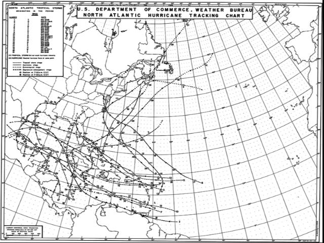
http://en.wikipedia.org/wiki/File:1933_Atlantic_hurricane_season_map.png
The 1933 Hurricane season was the second most active on record, but no storms were reported in the mid-Atlantic. This was typical of the era – the technology did not exist to track or locate far offshore hurricanes in real time.
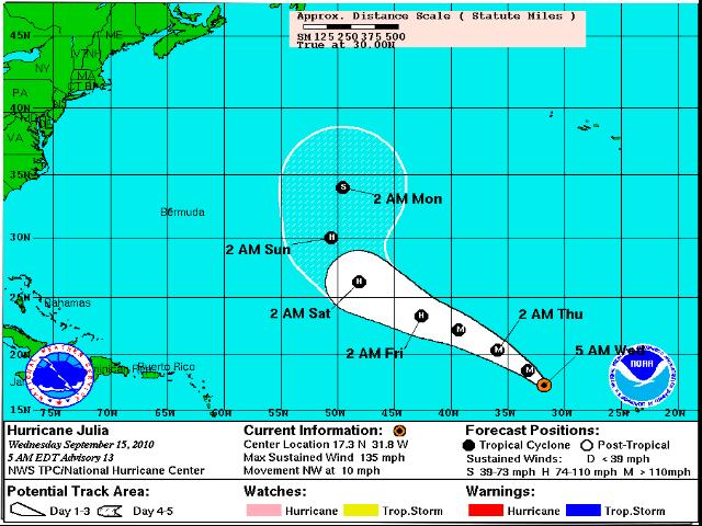
Julia is located out in the dead zone of the 1933 map. Chances are that in 1933 she would have been completely missed.
http://www.nhc.noaa.gov/storm_graphics/AT12/refresh/AL1210W5_NL+gif/145313W5_NL_sm.gif
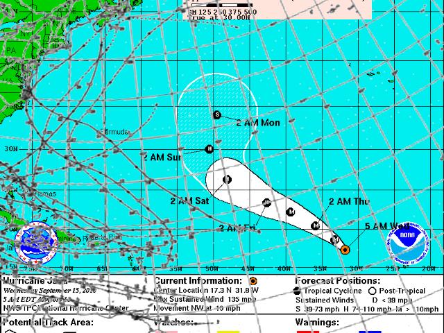
Below is an overlay of the two maps. They use different projections, but if we could correct for that, it would place Julia even further out into no-man’s land.
Julia is listed as a major hurricane, but in the past she might have been completely missed. We need to be careful when doing historical comparisons.


The predicting capability remained poor during the 1930s. The NYT run a comment on 22 September 1939: “Hurricane Anniversary” (Excerpts):
___On Sept.21, just a year ago, a tropical hurricane swept up from the Caribbean and devastated New England.
___According to the Travellers Insurance Company it was the country’s costliest disaster.
___Property to the amount of $ 400,000,000 was damaged.
___We naturally inquire what the Weather Bureau is doing to forewarn us when danger threatens.
___Despite its admirable service it did not acquit itself with glory last September.
___For lack of sufficient observations it had assumed communities along the coast that the hurricane would expend itself somewhere in the Atlantic.
The comment closes with information that observation has improved with observation stations in the United States and vessels in the North Atlantic.
Wouldn’t the pirates of Bermuda said something?
Pingback: Puncturing the false picture of a scientific consenus about the causes and effects of global warming « Fabius Maximus