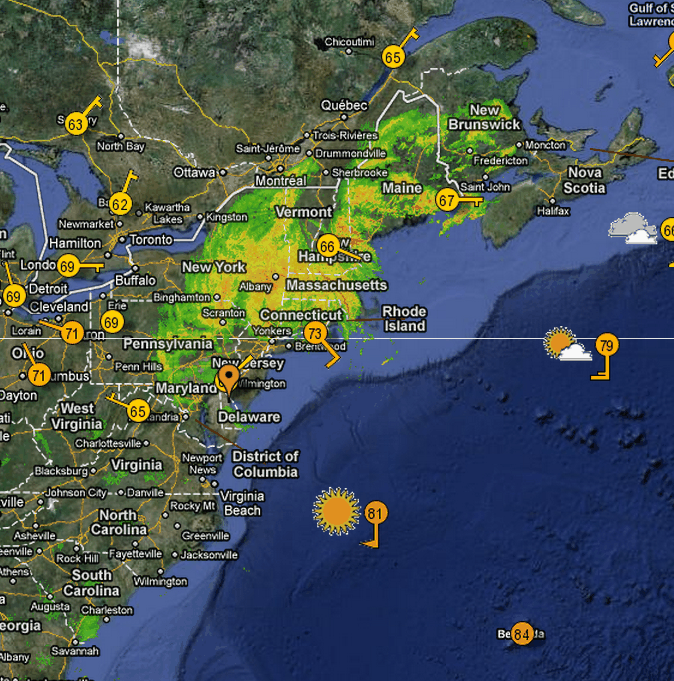
I did this GFS/WRF run on Friday.
[youtube=http://www.youtube.com/watch?v=0wzaq3g7UgI]
Compare with what actually happened. It got rainfall, wind speed and the shape of the storm almost perfect.
Kudos to NOAA and NCAR weather modelers, who were dead on. Almost perfect. Where were politicians getting their information from?


Where oh where did she disappear to! Where oh where could she be! Irene has lost her way. Someone needs to help her find her way home!
I don’t give them that much credit….
They had Irene going into the Gulf at one point….
…last Sunday going straight up the center of Florida as a Cat4
then a later run hitting Miami
Then later coming out of the north Bahamas as a Cat3-4 heading for South Carolina
Then a question about turning west and hitting Jacksonville
Intensity has been all over the place…..Irene fell apart when it should have strengthened – twice
No, they’ve been all over the map with Irene, both track and intensity…..
Steven:
The politicians were getting their forecasts from NOAA! It is the NOAA’s position to understand the earth from the top of the atmosphere to the bottom of the oceans.
I am going to C&P form their site:
NOAA is launching a comprehensive initiative to build a “Weather-ready” nation to make America safer by saving more lives and protecting livelihoods as communities across the country become increasingly vulnerable to severe weather events, such as tornado outbreaks, intense heat waves, flooding, active hurricane seasons, and solar storms that threaten electrical and communication systems.
NOAA is also announcing that the United States has so far this year experienced nine separate disasters, each with an economic loss of $1 billion or more — tying the record set in 2008. The latest event to surpass the $1 billion price tag is this summer’s flooding along the Missouri and Souris rivers in the upper Midwest. This year’s losses have so far amounted to more than $35 billion.
For the complete “Story”, I use the term loosely,:
http://www.noaanews.noaa.gov/stories2011/20110817_weatherready.html
They are naming as many clouds as they can, as fast as they can….
Jose is at best 40 mph winds and not even predicted to make it 24 hours
….but a squall line we would not have even known about a few years ago, has a name