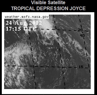
I’m guessing that bonuses at NOAA depend on the number of clouds which they name.

DISCUSSION AND 48-HOUR OUTLOOK
——————————
AT 500 AM AST…0900 UTC…THE CENTER OF TROPICAL DEPRESSION JOYCE
WAS LOCATED NEAR LATITUDE 16.9 NORTH…LONGITUDE 45.0 WEST. THE
DEPRESSION IS MOVING TOWARD THE NORTHWEST NEAR 14 MPH…22 KM/H. A
MOTION IN THIS DIRECTION AT A FASTER FORWARD SPEED IS EXPECTED
DURING THE NEXT TWO DAYS.
MAXIMUM SUSTAINED WINDS ARE NEAR 35 MPH…55 KM/H…WITH HIGHER
GUSTS. LITTLE CHANGE IN STRENGTH IS FORECAST DURING THE NEXT 48
HOURS.
Near 35 MPH at altitude in the middle of the Atlantic. Chalk another funny one up for the team.


surf’s up!
Another hyperactive hurricane season, all caused by man! We are doomed (sarc)!!
The agenda demands increased extremes, so what’s extreme must be redefined.
Of course in the end, people see through this, & then this is through.
At NOAA, the priorities are clear: give your political bosses what they want (i.e. data confirming a warming planet), keep your job, and get invited to the next junket in Rio. Don’t let “science” or the facts get in the way of job security or a free vacation.
I thought that’s how they were always defined. Less than 38 mph is a depression, greater than just 39 mph is a tropical storm.
I guess that means we have a tropical storm here every day on the Prairie’s! 🙂
What are these mph? Some kinda metric nonsense? Real men use knots. 34 for a tropical storm, to be precise. Also, that whole rotation & clouds things. Those are important, too.
Using climate science math , “NEAR 35 MPH” means 18 MPH. In other words, a stiff breeze.
Joyce briefly reached Tropical Storm strength: http://www.nhc.noaa.gov/archive/2012/al10/al102012.public.005.shtml
Yes, with the NHC’s hypersensitive detection system, any squall in the Atlantic basis with gusts to 39 mph is fair game.