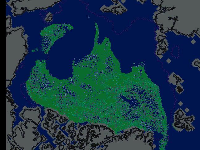
The modified NSIDC image above shows the maximum possible amount of multi-year ice (MYI) we could have in spring 2011. It assumes that all of the 2+ year old ice from the end of July remained intact.
The actual amount will be less. Some has already melted and more will melt in the North Atlantic over the winter.
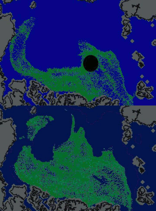
Compare potential 2011 MYI vs. end of March, 2010 MYI in the blink comparator below.
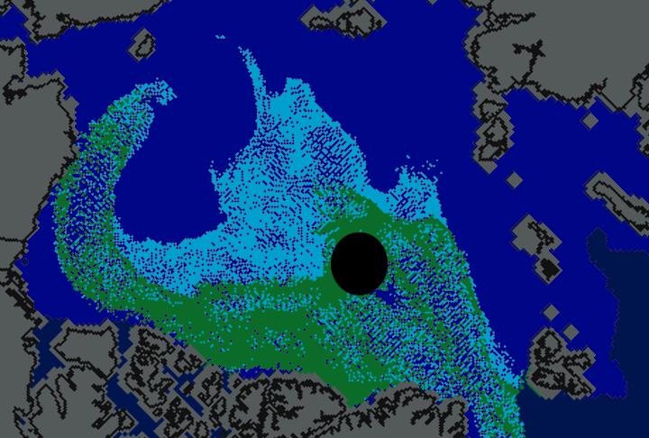
Depending on the wind this winter, we could see a large increase in MYI in 2011 relative to spring 2010. The 2010 MYI image was generated by removing all of the ice less than two years old (turquoise) from the modified NSIDC image below.


There was more multiyear ice this year too but it hasn’t done much good. Given the rotten aspect of the multiyear ice
http://www.iup.uni-bremen.de:8084/amsr/arctic_AMSRE_visual.png
does it actually mean anything when trying to guess 2011?
Andy
We are essentially at the Arctic sea ice minimum for 2010 right as we speak, and all but one extremely small piece of that arm of multiyear ice north of Alaska has been lost. (this should become clear if the NSIDC’s “Arctic Sea ice News & Analysis” issued in early October shows an ice age map as did that in October 2009.) We have, however, had the ice in the central Arctic survive and “mature” another year, it is just a matter of how much of that will exit out Fram Strait in 2011 versus entering the Beaufort Gyre. The ice this year almost looks like 2008 plus an extra arm extending into the East Siberian Sea. Over the winter this arm will get broken up and stretched to become a thin, low-density ribbon of isolated second-year ice floes interspersed with first-year ice by the time Spring 2011 comes around. (This will become clear in the April 2011 NSIDC arctic sea ice news) It will thus not present any real challenge to melting in the summer of 2011. I therefore feel confident in saying that, barring anomalously cool or cloudy weather in June and July of 2011, the single-day ice minimum in 2011 will be near or below that of this year, that is, less than 5.0 M km^2 according to JAXA. This is a prediction.
So as to not be accused of changing the rules after the game has begun, let me establish right from the very beginning that the temperatures used in the definition of “unusually cool” are to be determined for the Pacific sector of the Arctic, see
http://www.esrl.noaa.gov/psd/cgi-bin/data/timeseries/timeseries.pl?ntype=1&var=Air+Temperature&level=2000&lat1=90&lat2=68&lon1=90&lon2=225&iseas=1&mon1=5&mon2=5&iarea=1&typeout=2&Submit=Create+Timeseries
I am most definitively NOT referring to the DMI polar temperature bulls**t. The region from 80-90N is utterly irrelevant as long as most of the ice which is melting is between 70 N -80 N.