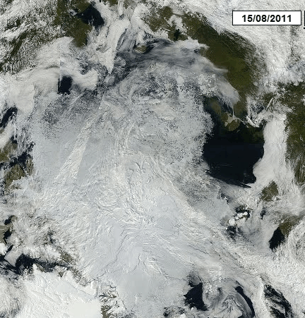
Over the last three months, the ice edge off Alaska has retreated 200-300 miles towards the pole. In order to have an ice free Arctic, it would have to retreat another 1000 miles. This tells me that in order to have an ice-free Arctic, the Arctic summer would probably have to be much longer than it is.
Only problem is, the sun is low on the horizon and will be setting in a few weeks. I think that ice-free Arctic claims are 100% unadulterated BS.


Wouldn’t you have to stop the sun from setting??
Steve,
I think people at NSIDC are using some algorithms to fill in missing data. I must be missing something because nobody else seems to have remarked on the gray patches of missing data from their maps. Both the Arctic and Antarctic seem to be on the fritz. Could they be filling in the holes using some sort of algorithm? Just asking.
I think they use data from other satellites
” To prevent discontinuities, the sea ice extent timeseries interpolates to fill in missing data when necessary.”
As long as they have data for dates bracketing the missing bit, they can average the before/after figures for the region in question. As for what they do on the exact day a swath drops out, I’m not quite sure – at that point they only have the “before” values. I would suspect they just run with the previous day’s data for the pixels in question until they have an “after” to interpolate from.
WAG!
Sorry! They claim to be scientists so it would be SWAG!
Some swaths are late coming in, which is why you see gray areas in the extent map at the moment. When we receive them, they are added to the day.
Steve has taken a lot of grief from a lot of people this summer, but both he and the Arctic Ice have stood their ground quite nicely.
Regarding arctic.io ‘s satellite photo mosaic from MODIS ; what is all that light blue off the north coast of Norway? Herring? Sediment?
It’s a Blue Herring.
It is Phytoplankton, here is close view:
http://www.arctic.io/observations/8/2011-08-16/7-N72.636149-E33.72461