
COI | Centre for Ocean and Ice | Danmarks Meteorologiske Institut
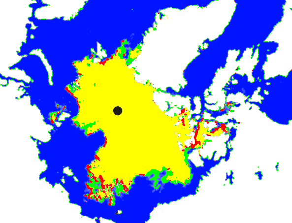
There has been essentially no change in ice coverage this month. green shows gain since September 1. Red shows loss.
COI | Centre for Ocean and Ice | Danmarks Meteorologiske Institut
There has been essentially no change in ice coverage this month. green shows gain since September 1. Red shows loss.

Steve,
You and the others here at Real Science will appreciate this forecast. Remember the [Communist] Peoples March for Climate Justice and the UN meeting on Climate is happening in NYC the week of September 21st. I had hoped for snow or ice for NYC to greet the useful idiots. Seems I may be getting an early birthday present:
With luck this forecast is correct and that “strong upper level low with the accompanying threat of some cold Arctic air” will arrive in NYC on the 21st just in time to dump cold reality on the Climate Justice March.
Temperatures in the eastern 2/3 of the US are going to be way below normal over the next week.
68%? Toss out the refrigerators! Just set the cold cuts on the glacier coming to a neighborhood near you.
When the coastal zones are included, the extent is much higher, closer to MASIE results.
http://ocean.dmi.dk/arctic/icecover.uk.php
The gain in the Beaufort (and other areas as well) really isn’t gain at all. That ice has been there. Its just that the microwave sensors weren’t picking it up before. It is colder now, so that ice is hardening up and has become a hard target. MASIE, CIS and Russia much better in there detection methods. But I understand your just comparing apples to apples through DMI.
Right on, Brian D. I compared MASIE and NOAA since 2006. MASIE always showed greater extent, averaging 700,000 Km2 more both at maximum and minimum.