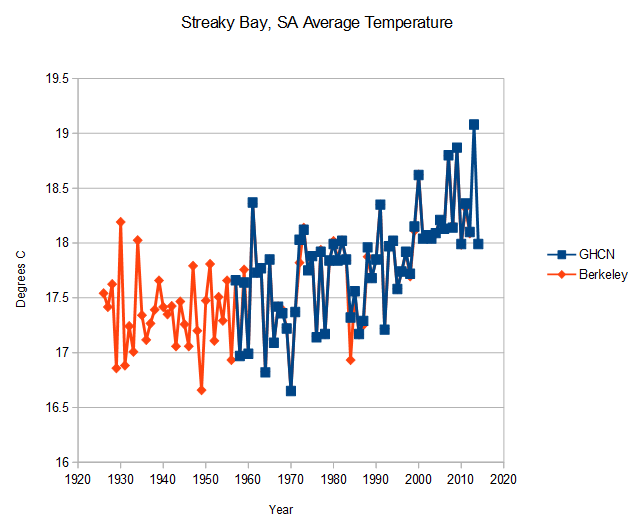
Streaky Bay, SA shows warming over the past century. And like most other Australia stations, the GHCN data prior to 1957 is missing.
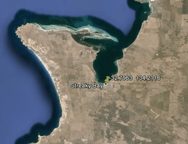
The thermometer is close to the Bay.
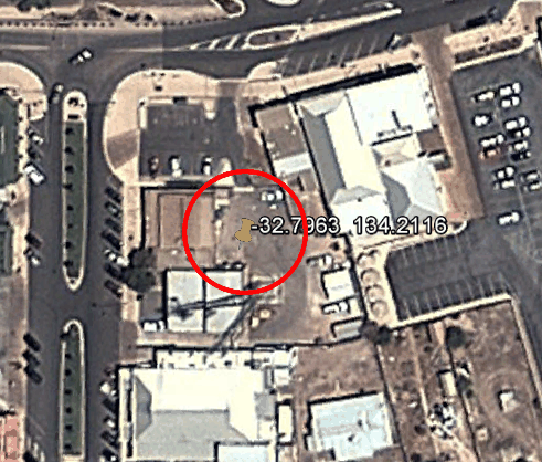
And Google Earth shows it right in the middle of a jungle of asphalt and buildings.


Looks like a perfect thermometer to use as the starting point a BOM homogenisation routine. 🙂
Notice, no “adjustment” needed, because UHI already provides the prescribed warming.
Hot in the ocean too.
http://sharkyear.com/2012/news-video-shark-attacks-surfer-in-streaky-bay-sa.html
“Australia is a shark-infested country, with three different grades of probabilities – mild (Northern Territory, Tasmania and Cocos Islands), moderate (Western Australia, South Australia and Victoria) and severe (Queensland and New South Wales).”
http://www.surfertoday.com/surfing/8818-the-most-shark-infested-waters-in-the-world