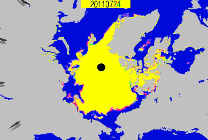
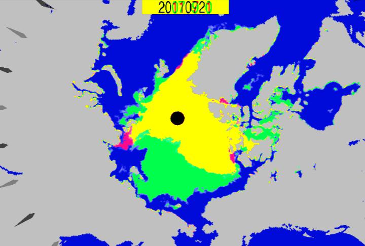
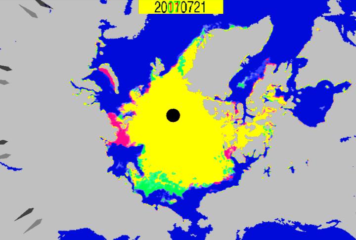
Loss during the the last seven days.
How far it has to go to get to a record.
Comparison vs. the same date in 2007. During July 2007, ice was disappearing from the East Siberian Sea very quickly. That is not happening in 2011, and why the chances of a record low are pretty close to nil.


Given the amount of thick ice and the cool weather pattern in place, do not think there is going to be a huge decrease in ice cover during the rest of the season. If I had money to bet, I’d pick the higher end of the range.
I’m jumping briefly into the twilight zone since I’m very busy writing an article about the psychotic preachers that are endorsing Rick Perry’s “day of prayer”.
Concerning this thread; who do you think you’re kidding? You are using looooow resolution images. Why aren’t you going to The Cryosphere Today? Is it because you might want to…….cry? Grrroan 🙂
By the way, looks like the North Passage will open up within a week. If I recall, that would be about 3 weeks before its opening date last year. :-0
Here is a real, manly, ice concentration image.
http://arctic.atmos.uiuc.edu/cryosphere/NEWIMAGES/arctic.seaice.color.000.png
Fascinating. ZZZzzzz…
Why don’t you go sleep on a “sturdy” ice floe?
Almost all of the ice shown in {http://arctic.atmos.uiuc.edu/cryosphere/NEWIMAGES/arctic.seaice.color.000.png} is above 80% concentration – different colour scale.
Wow, three weeks early? That is unprecedented. Just like this:
1944 – Schooner sails NW passage in 86 days along most northerly route. “The northwest passage is suitable for summer traffic by wooden vessels” according to Staff Seargant Henry Larson.
http://news.google.com/newspapers?id=bidkAAAAIBAJ&sjid=jHsNAAAAIBAJ&pg=968,1250469&dq=arctic+record+%7C+melt&hl=en
He guess you don’t read your cited articles too well. In a chapter clearly titled “Ice all the way” It says that “He encountered heavy fog and ice floes all the way through the passage”.
Now why can’t you understand that OPEN means NO ICE? That is what has been happening in the past few years-OOOOOOOOPEN-with no need to maneuver through ice floes.
Give it up Steve, you’ll simply have a different and contradicting tale to tell 5 years from now along with the usual selective amnesia
Good luck getting through there now.
Yea, that is why he concluded that the passage was suitable for traffic by wooden boats? Me thinks it is you that didn’t read. If it wasn’t open, they wouldn’t have made it through. This wasn’t a ship with the ability to push through ice pack.
The Titanic sailed through an ice flow. Does that mean the North Atlantic wasn’t “open”.
You’re mixed up religion and politics you don’t like consistently with science you know it.
You’ve tainted yourself, Ill, because the people you like believe in AGW. The people you don’t have a particular love for don’t believe it.
Like this? http://mgds.ldeo.columbia.edu/healy/reports/aloftcon/2011/20110719-2101.jpeg
Shocking. Normal summer conditions in the Arctic.
J Calvert: “Like this?”
Like what? What locationis that supposed to be and what relevancy does does that have to the points I made?
Looks like we are headed for a record low, eh?
ha ha ha send him out there with an acetylene torch to make it happen
“Looks like we are headed for a record low, eh?”
Looks like we’re still ‘trailing’ 2006.
http://nsidc.org/data/seaice_index/images/daily_images/N_stddev_timeseries.png
The location is at the top of the photo
73 N 150W 19th July 2011 (9pm) i.e. last Tuesday evening, some way north of Alaska. People (quite a few) walking around on the ice. Hard to tell, but some might be lying down on it!
Here’s July 21, 2007:
http://arctic.atmos.uiuc.edu/cryosphere/IMAGES/ARCHIVE/20070721.jpg
Here’s July 21 2011
http://arctic.atmos.uiuc.edu/cryosphere/NEWIMAGES/arctic.seaice.color.000.png
Look at the differences in ice concentration between the two at the NW and N passages. Also, whereas 2007 has a substantial amount of 98%+ concentration, 2011 has a substantial amount of that area in 85-95% concentration.
Also check out the 60% red compared with 2011 concentration in the same area. Furthermore, 2011 has a bit of 30-50% around the edges indicating rapid melt.
The overall picture is that 2011 with less concentration than 2007.
Here’s July 21, 2007:
http://arctic.atmos.uiuc.edu/cryosphere/IMAGES/ARCHIVE/20070721.jpg
Here’s July 21 2011
arctic.atmos.uiuc.edu/cryosphere/NEWIMAGES/arctic.seaice.color.000.png
Look at the differences in ice concentration between the two at the NW and N passages. Also, whereas 2007 has a substantial amount of 98%+ concentration, 2011 has a substantial amount of that area in 85-95% concentration.
Also check out the 60% red compared with 2011 concentration in the same area. Furthermore, 2011 has a bit of 30-50% around the edges indicating rapid melt.
The overall picture is that 2011 with less concentration than 2007.
Those concentration maps are completely useless this time of year.
“Those concentration maps are completely useless this time of year.”
Sure Steve, sure. So why don’t you just put anything to do with the ice cap in the back burner until mid Spetember?
Ill wind transulation
http://www.youtube.com/watch?v=GZfnTNyZoHY&feature=related
You guys are really not comparing apples to apples…
The Russians have had three of their nuclear ice breakers up there for the past few months clearing the way from Dickson to Tiksi and Pevek.
They have oil exploration going on in Tiksi and they are using the old tin factory in Pevek as a staging ground.
This is exactly the same thing they did last summer.
That was the purpose of building the nuclear ice breakers, so they could operate 7 days a week, around the clock and not have to go back to port.
These are the ones they had in Barents earlier this year.
They are breaking up the ice in the passage as fast as they can and will be doing that every year from now on…………………….
Glacierman:
The Titanic sailed through an ice flow. Does that mean the North Atlantic wasn’t “open”.”
Oh my Gaaaawd!!! It was an ICEBERG that sunk the Titanic you doofus!!! Ice concentration or lack thereof was ABSOLUTELY IRRELEVANT.
You don’t have icebergs floating in the Northern or Northwest Passage or the Arctic!!!
Now write this on the blackboard a 1001 times:
Icebergs have nothing to do with the NW or NE passages.
Icebergs have nothing to do with the NW or NE passages.
Icebergs have nothing to do with the NW or NE passages.
Icebergs have nothing to do with the NW or NE passages.
Icebergs have nothing to do with the NW or NE passages.
Icebergs have nothing to do with the NW or NE passages.
Icebergs have nothing to do with the NW or NE passages.
Icebergs have nothing to do with the NW or NE passages.
icebergs have nothing to do with the NW or NE passages.
Icebergs have nothing to do with the NW or NE passages.
Icebergs have nothing to do with the NW or NE passages
Icebergs have nothing to do with the NW or NE passages.
As soon as a ship can get through, the Arctic is ice free. Ships are like 3,000 miles wide.
That’s not as the big as the gap in the logic that connects this with AGW
I never said that. Just comparing your response that if ice was present the passage was not open. Very faulty logic, but based on other things you have said, not all too surprising.
Continue to pass gas, I’m out.
The Arctic Ocean is going to be ice free soon. Seriously. Just because it will have ice in it doesn’t mean it’s not ice free. Also, we don’t have any mechanism to predict this, but spreadsheets are valid in this context because that’s what people who use the word “impact” because they can’t sort out “effect” and “affect” in their Climate Adjusted minds use to predict things that it turns out they can’t predict to within a 100% margin of error.