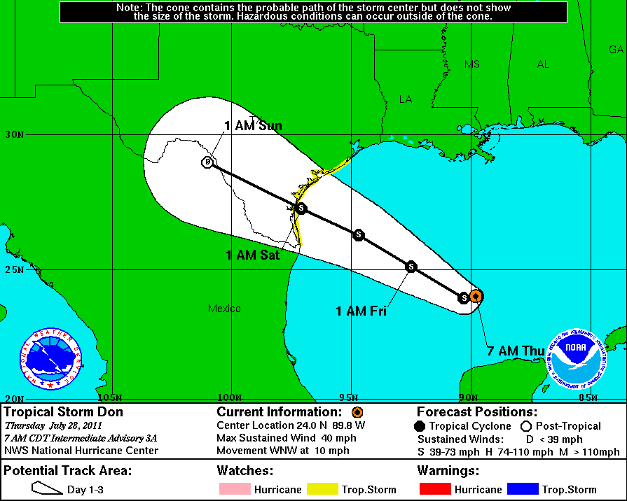
40 MPH winds are about average here in the spring.
Disrupting the Borg is expensive and time consuming!
Google Search
-
Recent Posts
- Analyzing The Western Water Crisis
- Gaslighting 1924
- “Why Do You Resist?”
- Climate Attribution Model
- Fact Checking NASA
- Fact Checking Grok
- Fact Checking The New York Times
- New Visitech Features
- Ice-Free Arctic By 2014
- Debt-Free US Treasury Forecast
- Analyzing Big City Crime (Part 2)
- Analyzing Big City Crime
- UK Migration Caused By Global Warming
- Climate Attribution In Greece
- “Brown: ’50 days to save world'”
- The Catastrophic Influence of Bovine Methane Emissions on Extraterrestrial Climate Patterns
- Posting On X
- Seventeen Years Of Fun
- The Importance Of Good Tools
- Temperature Shifts At Blue Hill, MA
- CO2²
- Time Of Observation Bias
- Climate Scamming For Profit
- Climate Scamming For Profit
- Back To The Future
Recent Comments
- conrad ziefle on Analyzing The Western Water Crisis
- conrad ziefle on Analyzing The Western Water Crisis
- Bob G on Analyzing The Western Water Crisis
- Gordon Vigurs on Analyzing The Western Water Crisis
- Bob G on Analyzing The Western Water Crisis
- Bob G on Analyzing The Western Water Crisis
- Bob G on Analyzing The Western Water Crisis
- Mike Peinsipp on Analyzing The Western Water Crisis
- Bob G on Analyzing The Western Water Crisis
- Bob G on Analyzing The Western Water Crisis


Looks like we will continue to add to the “no landfalling hurricanes” counter for a bit longer.
lol, 40 mph!!! Wow, so, if it does make landfall, what would we call it? A shower?
40 mph doesn’t even count as a windy day in Corpus Christi — Don’s current target, give or take. I just hope it brings lots of rain.
Do either Home Depot or Lowes have a vested interest in Tropical Weather hysteria?
Had worse weather than that in Chicago last night.
122-year rainfall record for July falls, more coming
http://www.wgntv.com/news/local/breaking/chi-isolated-storms-may-produce-60-mph-gusts-20110727,0,983869.story
The central pressure just dropped 10 millibars between updates.
Rapid intensification is a possibility with any tropical cyclone. That is why it is a good idea to keep an eye on them.