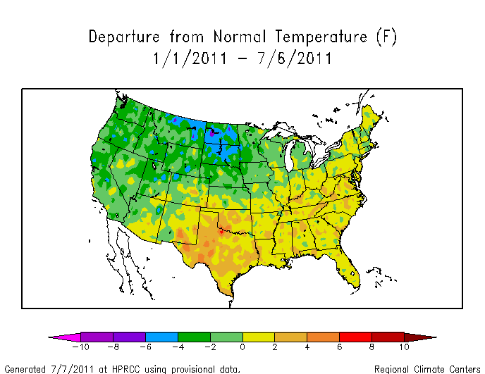
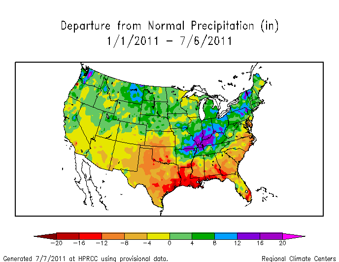
Top scientists tell us that higher temperatures means more moisture in the atmosphere and heavier precipitation. Therefore drought must be caused by cold, and heat must be associated with flooding and record snow.
This explains the hot/dry conditions in Texas this year, the cold/wet conditions in North Dakota, The Dust Bowl and last summer’s heat and drought in Moscow.
It also explains why the temperature /precipitation departure maps mirror each other.
NOT.


at wasst! You awe finawwy speaking wogicawwy!
The inches departure from normal precip shown in the upper Missouri watershed is quite a bit less than that shown here: http://water.weather.gov/precip/index.php?yday=1309996800&yday_analysis=0&layer%5B%5D=0&layer%5B%5D=1&layer%5B%5D=4&timetype=RECENT&loctype=STATE&units=engl&timeframe=last180days&product=dep_normal&loc=conus
I wonder which one the USACE used for this years runoff forecast?
Of course the earth is wetter globally/annually when warmer globally/annually.
That is why it rains so much on Venus.
time for another update on Lake Powell…it is getting to historically “average” levels and may even have a shot at “FULL” or a record, although that would take a considerable good amount more water!
You don’t have to be a meteorologist to visualize the stalled out cold front near the Ohio Valley for the last six months, clearly resulting from CO2 induced global weirding and jetstream disruption.
I see that the SO2 plume from the Chinese coal-fired stations is spread over the north-west, with a “hot spot” (cold spot?) over N & S Dakota.
Andy, please demonstrate the cause and effect.