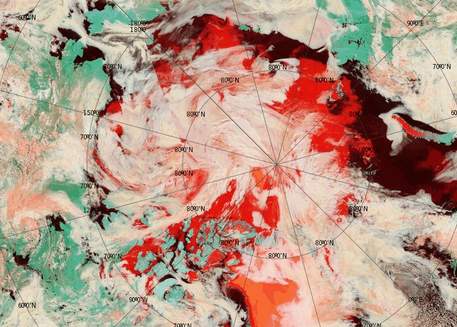
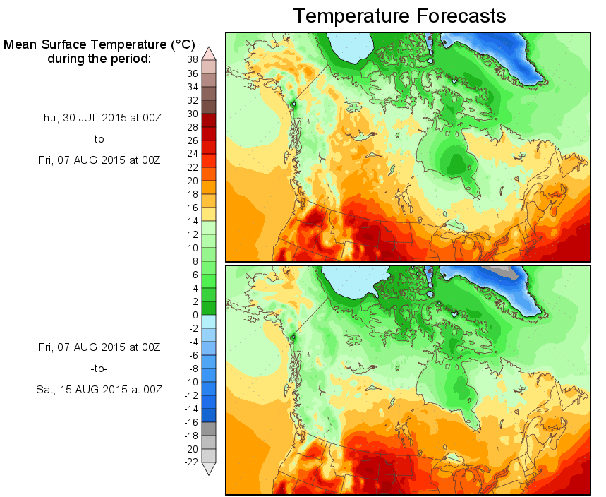
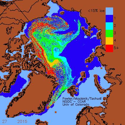
The Arctic Basin is full of ice, most of which is thick multi-year ice – and cold temperatures have settled in over the region.
In a few weeks, there will be a huge increase in four year old ice, as the three year old ice (green) reaches its birthday. Most of the Arctic Basin is now covered with multi-year ice.
Arctic sea ice is making a very strong recovery, but government funded climate criminals will not mention this – because they are paid to generate global warming propaganda for the White House, not disseminate factual information.


Don’t bank on it, they will probably find some way of reclassifying it.
It would be a pretty stupid person (in the US) who starts fabricating data this late in the day with a presidential election next year which could give the Republicans free rein to hold inquiries, police investigations, prosecutions, impeachment, etc.
Remember most public sector employees are far more interested in having a pension than risking prison for their politics.
I think you underestimate the ability of the those preparing the data to change the data, without actually lying.
For example, they could remove the 5+ category and replace it with 4+.
Haven’t they already done something similar?
Regretfully, Republications and Democrats, Communists and Capitalists, Liberals and Conservatives all agreed with Stalin on October 24, 1945:
“Better Red Than Dead!”
The top ten highest weeks for solar insolation are now past. The end of the arctic summer is here as the sun sets now at ~71 Degr. N Lat. The areas of sub-zero temps are getting bigger every day. Some of the Bouys have recorded more sub-zero time over the last several days than time above-zero.
The archipelago is tracking pre-07 years in total ice and MYI. A big regional recovery. Greenland will see the temps plummet and its remarkably short melt season looks to be over.
The wild card is the big storm forming over the Beaufort. The heavy clouds will bring cold temperatures early. But how much of the energy in the water will be used to melt ice and how much will be evaporated and radiated away into the storm clouds?
The storm is pretty far north, and will likely increase extent by pushing ice towards the Alaskan Coast
So then they will start lying about “volume” and extent won’t be important anymore!
I’ve noticed this “moving the goal posts” phenomenon already.
Look at the Antarctic – the metric down there is now *more* sea ice is due to global warming! Hansen is saying that his new model “predicts” increased Antarctic sea ice from global warming, unlike all the other climate models (which are obviously inferior – heh).
Then is was more hurricanes. When that didn’t pan out, then it was fewer hurricanes, but they would be more “powerful”. And tornadoes too. Until those numbers dropped.
Then it was drought. But then the midwest was drenched and is no longer in drought, and even Califronia and the southwest are both seeing more rain now (in line with the current El Nino conditions).
So yes these climate researchers will move the goal posts when it suits them in order to keep the science money coming in.
Excellent series of posts Tony … I’m cheering for the arctic recovery to put a damper on the Paris fustercluck but of course the loons of the left will say any increase in arctic sea ice is due to all the heat (hottest ____ evah!! ) and climate change!
I wish it were only the US government – “they are paid to generate global warming propaganda for the White House, not disseminate factual information“ – but the same garbage is being generated by heads of all nations Stalin combined into the United Nations on 24 October 1945!
It’s interesting how NSIDC shows NO ice in Hudson Bay.
http://nsidc.org/data/seaice_index/images/daily_images/N_daily_extent_hires.png
Canadian Ice Service shows lots of ice!
http://www.ec.gc.ca/glaces-ice/default.asp?lang=En&n=D32C361E-1
Not sure why the image for NSIDC shows 7/26/2015, if you click the image it shows the current one correctly.
i have just sent off an email to environment canada asking the question,so hopefully will get a reply clarifying the massive discrepancy.
NSIDC uses 15% cut off. Canadian Ice Service shows all. Even 0-15%.
That’s not it. The Canadian data is color coded by concentration and most of the area is over 30 %. The NSIDC is omitting all the ice area–even the high concentration regions.
http://ice-glaces.ec.gc.ca/prods/WIS30CT/20150730180000_WIS30CT_0008392802.pdf
i agree with crashx, there are big areas of 9/10 ths concenytation of pretty thick ice. none of it is showing up. this possibly highlights problems satellites have detecting sea ice.
“this possibly highlights problems satellites have detecting sea ice.”
Since the Canadians are using satellite data
and the Navy’s HYCOM/ARC is using satellite data,
and EOSDIS World view is using satellite data,
and DMI is using satellite data…
The problem highlighted by the NSIDC plots is that the analysis, methodology and programming used by NSIDC is erroneous and biased to exclude ice that is present. They will state that it is necessary to not count ice that isn’t there. The bias error in the NSIDC plots, as well as the ubiquitous CT plots, always lowballs concentration and area. The simplest check is watching the low concentrations assigned to the fast ice regions of the archipelago.
The hidden feature is that the updates to the methodology and cutoff brightness temperatures are changed every few years so that the details of the measurements made in 1980 are different then in 2005 which is different then 2009 which is different then 2014…etc. Those ice area plots over time are not true apples-to-apples comparisons.
thanks for the explanation crashx . i did wonder how consistent the techniques for assigning ice concentration and coverage were over the satellite era . if the bastardisation of temperature records is anything to go by it does not surprise me to learn there have been changes to the methodology in ice measurement.
http://ice-glaces.ec.gc.ca/Ice_Can/CMMBCTCA.gif
http://home.comcast.net/~ewerme/wuwt/cryo_latest.jpg
http://www7320.nrlssc.navy.mil/hycomARC/navo/arcticicennowcast.gif
The ice is still there, despite a surge of hot prairie air up that way, and a resultant low pressure system now whirling in the north of the Bay. The ice will be there into August, at least.
there’s a lot of three year old ice!….3 years ago would be 2012
I thought 2012 was a low ice year??
but all the ice that was there,is still there.
that’s what I mean Andy…there’s a whole lot of ice still there from 2012
ok, looked at the volume graph….yes, volume has been going way up since 2012
Where are the cruise ships and icebreaker escorts sailing through the melting arctic so that their brave passengers can observe first hand the devastation caused by man?
I’ve been wondering the same thing. I count on their Facebook pictures to inadvertently show that the ice is still there. If anyone knows of a yacht attempting the passage, alert me. Or a row boat. Or a ski-do.
i keep an eye on the northwest passage 2015 blog . those actually in the arctic tend to paint a vastly different picture than the desk bound scientists .
I agree, though sometimes they talk-the-talk of alarmism even while walking-a-walk that seemingly should be waking them up to discrepancies between theory and reality.
Thanks for the link.
sorry caleb, i forgot the link http://northwestpassage2015.blogspot.co.uk/
That’s a good news, but we should keep in mind what led to the warming event in the past. The facts are very clearly explained here: http://www.arctic-warming.com/?page_id=46.