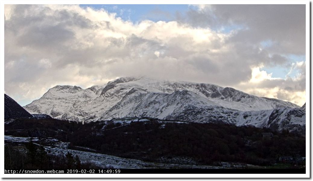
Climate experts say Mt. Snowdown will be snow-free by next year.
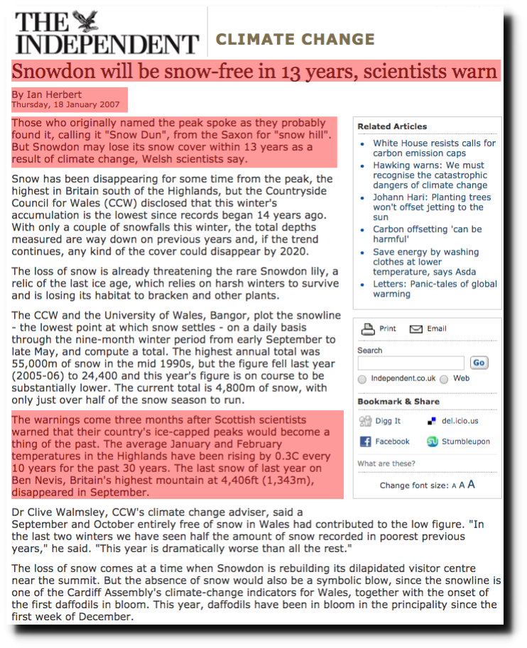
Disrupting the Borg is expensive and time consuming! Please help with a gift by clicking the button below.
-
Recent Posts
Recent Comments
- conrad ziefle on Killing Cows To Save The Climate
- arn on Killing Cows To Save The Climate
- Kevin M on Killing Cows To Save The Climate
- GWS on Killing Cows To Save The Climate
Archives
- May 2023
- April 2023
- March 2023
- February 2023
- January 2023
- December 2022
- November 2022
- October 2022
- September 2022
- August 2022
- July 2022
- June 2022
- May 2022
- April 2022
- March 2022
- February 2022
- January 2022
- December 2021
- November 2021
- October 2021
- September 2021
- August 2021
- July 2021
- June 2021
- May 2021
- April 2021
- March 2021
- February 2021
- January 2021
- December 2020
- November 2020
- October 2020
- September 2020
- August 2020
- July 2020
- June 2020
- May 2020
- April 2020
- March 2020
- February 2020
- January 2020
- December 2019
- November 2019
- October 2019
- September 2019
- August 2019
- July 2019
- June 2019
- May 2019
- April 2019
- March 2019
- February 2019
- January 2019
- December 2018
- November 2018
- October 2018
- September 2018
- August 2018
- July 2018
- June 2018
- May 2018
- April 2018
- March 2018
- February 2018
- January 2018
- December 2017
- November 2017
- October 2017
- September 2017
- August 2017
- July 2017
- June 2017
- May 2017
- April 2017
- March 2017
- February 2017
- January 2017
- December 2016
- November 2016
- October 2016
- September 2016
- August 2016
- July 2016
- June 2016
- May 2016
- April 2016
- March 2016
- February 2016
- January 2016
- December 2015
- November 2015
- October 2015
- September 2015
- August 2015
- July 2015
- June 2015
- May 2015
- March 2015
- January 2015
With all these scientists making these ridiculous predictions and then being proven wrong, I would like to see them today and asked, How could you be so far off? Just once I’d like to hear Hanson explain himself. Why do these guys get off Scott-free?
They’ll say they were not “far off”, then proclaim that everything is happening because of CAGW. Next, they’ll be given praise and awards despite being spectacularly wrong.
Their credibility is based on how scary the predictions are, that we’re “doing it to ourselves”, and that they’re here to “save the planet”; it has absolutely zero to do with accuracy.
The irony of these people labeling *others* as “deni*rs” is truly mindboggling.
Climate experts say Mt. Snowdon may lose its snow cover by next year.
How often are those experts correct in their projections?
Phil.
The use of “may” by alleged scientists is not a “get out of jail free” card. Professionals must be held to a higher level of responsibility for their prognostications than Joe public. Yet the “cause” seems to grant them license to freely spout nonsense where it advances the politically correct message and none of their colleagues dare take them to task for their flights of fancy.
Misquoting them is not good practice, it’s fine to criticize what they say but not misquote them.
Now I get it. I know what you do when you are not here complaining about Tony!
You are writing letters to the editor, calling and emailing The Independent, The Grauniad, BBC, NYT, WP, CNN, MSNBC, ABC, NBC, etc. and demand they stop “misquoting” the experts, eh?
I always thought you were a busy beaver. Now I know.
I predict — very confidently — that Mt. Snowdon will lose its snow cover by this summer!
And your prediction beats those of climate ‘scientists’ by a mile!
Congratulations!
No Phail, activists say that. Actual climate experts do not make silly meaningless predictions about single hilltops.
Why do you defend alarmists, and dismiss the truth? Do you also hate poor brown people?
When it’s a national icon they do.
Its welsh name is Yr Wyddfa and has nothing to do with snow by the way. Sir John Hunt, Edmund Hillary practiced for their ascent of Everest.
Yes Phail, activists use local icons to scare people into submission. Witch doctors liked to use volcanoes.
Scientists do not stoop to theatrics.
Keep pretending to be intelligent, it’s working.
The image shown is one from a webcam today 2/2/19.
The mountain in the left foreground is the Alpspitze at 2,628 meters high, the 2nd highest summit in Germany. The mountain in the center in the background with the lights near the summit is the Zugspitze, the highest summit in Germany at 2,962 meters. The border with Austria is on the back side of the Zugspitze as you see it in the picture. Climbed the Zugspitze several times and been all over the German side of that mountain. It high up on that mountain that we once got caught in the worst winter storm to hit Bavaria in 10 years and survived a very rough night. In one way the two mountains are opposites. On the Zugspitze the ski runs are up near the summit but one can’t ski down to the tree line because of rocky precipices. On the Alpspitze the ski runs start at about the top of the tree line and one has to climb or get a ride on a helicopter to ski the top half of the mountain.
Back during the winter of 1986-87 I helicopter skied the Alpsptize from top to bottom. The ski instructors of 1st BN, 10 SFG(A) were given a day of being transported from one mountain to another by helicopter as a reward for our hard work training others to ski. They would take up to the top of a mountain and we would ski down and then they would pick us up and take us to the summit of another mountain and ski down it.
The Alpspitze is the 2nd highest peak in the German Alps. The bottom half has ski runs on it but the top half is pure Alpine wilderness above the tree line. That day was the first time I rode in a UH-60 Black Hawk helicopter. The reason for that was though at the time each SF Battalion was to have two UH-60’s assigned for their use, Special Operations Command in the states would not send the ones to Germany for the 1st Battalion because they knew that the Generals in Europe would steal them for the use of other units. So we got by using the old Huey helicopters usually. The UH-60 Blackhawk compared to the UH-1 Huey was like comparing a modern sports car to an old Volkswagen.
Anyway as you can see the Alpspitze is shaped kind of like the mountain from the Prudential Insurance commercials. The light on the near side marks the hutte at the top of the ski slopes on the mountain. The UH-60 did not land on summit but hovered with the right wheel on the summit and the left out over the sheer precipice as we got out of the right door. The decent down the slope was very interesting. Steep cliffs with sheer drop offs along the way that one could not see from above. You did not just take off but had to make long traverses and then at the turns look ahead and choose a path to traverse that would avoid the several cliffs. Thankfully that day the avalanche danger was minimal. So skiing that mountain was not nearly as fun as the several others that we skied that wonderful day. No matter the mountain though whenever one is getting out of a helicopter at the summit of a mountain they must be aware of the danger of the cornice. That windblown snow can look solid but it overhangs cliffs and a person can fall right through to their death.
Beautiful picture!
Rah, you are without a doubt the smartest, and coolest trucker I’ve ever come across, and have more worldly experience than two dozen average Americans. Keep the great comments coming.
It was the US Army that gave me those experiences. They made life hell sometimes but they paid me back in spades. A look at that image makes it clear why I Loved Germany. Look at the fog in that valley and imagine night skiing down into it.
That’s a great story, RAH.
I skied the Zugspitze with friends many times but it was on a weekend in the mid-80s when I was there solo and saw a large group of American GIs in military fatigues on the piste. They were young and fit, leaning back on their skis like bronco-riding cowboys, waving their arms, crashing and getting up again. Their hollering and laughter filled the whole bowl to the right of the ski lift I was on.
After watching them for a while I turned to a middle-aged man with top-of-the-line ski gear next to me on the chair and said something about the guys having a time of their life. He looked annoyed and I asked him how his day was going. He said that he was working hard on his skiing and looked away. He didn’t seem to appreciate the loud pandemonium in the bowl.
———-
Except for the hats and duds, this picture of a cowboy downhill race in Steamboat Springs is the closest thing to what I saw back then in Garmisch-Partenkirchen:
I also skied the Zugspitze several times. The first was to attend the German Army Ski Instructor course. We skied only the Zugspitze because the German instructors fit us in before they started training their own troops and it was so early in the season the slopes on the Zugspitze were the only ones open at the time.
I remember my typical lunch bought up there at the top of the mountain during that training was pickled herring, fresh baked brotchen, and some cheese. Bavaria in a nutshell can be described as the three exceptional “B”s. Beer, Bread, and Beautiful!
My son still talks about the still warm brotchen I would bring home from the Krone in Bad Tolz. That kid would start on them as soon as I brought them in the door and eat a dozen of the damned things before he’d had enough. All of my family loved the three years we were stationed in Bad Tolz.
We were there! And, erm, left our mark…
BTW Joe Bastardi’s Saturday Summary video is pure gold.
https://www.bbc.co.uk/news/uk-wales-47047347
Sounds to me like somebody probably screwed up. You pick your route to try and avoid that danger if at all possible and a lot of that kind of route planning can be done by referencing a contour map and talking to rangers or what ever the equivalent is in GB and others familiar with the mountain, especially climbers that have already done it under similar conditions. All that can be done before one foot is put on the mountain. However there simply are times it can’t be avoided and your forced to traverse across or below places where there is an avalanche danger. But when you do it you cross one at a time and not all together. BTW I believe that having the ability to know ones altitude combined with a contour map is the best way to navigate on the side of a mountain.