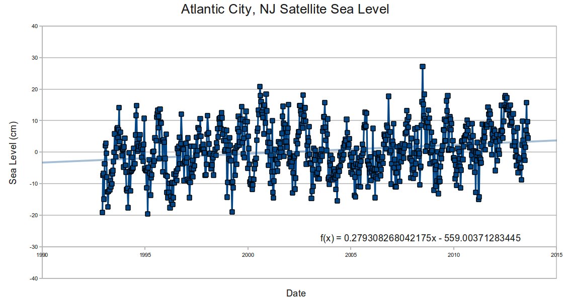
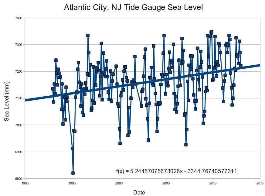
The tide gauge at Atlantic City, New Jersey shows almost twice the rate of sea level rise as satellite measurements.
Satellites show 2.8 mm/year, below the claimed global average.
Tide gauges show 5.2 mm/year, because fat people in the governor’s mansion are causing the state to sink.


That’s as good a theory as any I’ve heard proposed in the field of climatology.
I don’t think even a whole bunch of fat guys would sink the whole state. They could bend it, maybe.
Steve, twenty years isn’t enough to determine a robust sea-level trend, because of various cyclical processes, of up to 60 year duration. Click on “How long should an LTT sea level record be?” here:
http://sealevel.info/papers.html
and especially here:
http://pages.citebite.com/i3c5o5e8tyff
Also, note that satellites don’t actually measure sea-level on the coast. Physicist Willie Soon explains it very well in this excellent lecture:
http://www.youtube.com/watch?v=1gmW9GEUYvA#t=17m37s
NOAA reports that the Atlantic City tide gauge has measured a rate of sea-level change of +4 mm/year, with no evident acceleration, since the record began, 102 years ago:
http://tidesandcurrents.noaa.gov/sltrends/sltrends_station.shtml?stnid=8534720
Peltier (VM2) estimates that 1.65 mm/yr of Atlantic City’s apparent sea-level rise is due to subsidence (which is probably an underestimate).
Lucky for him that fat floats…