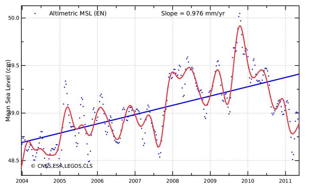
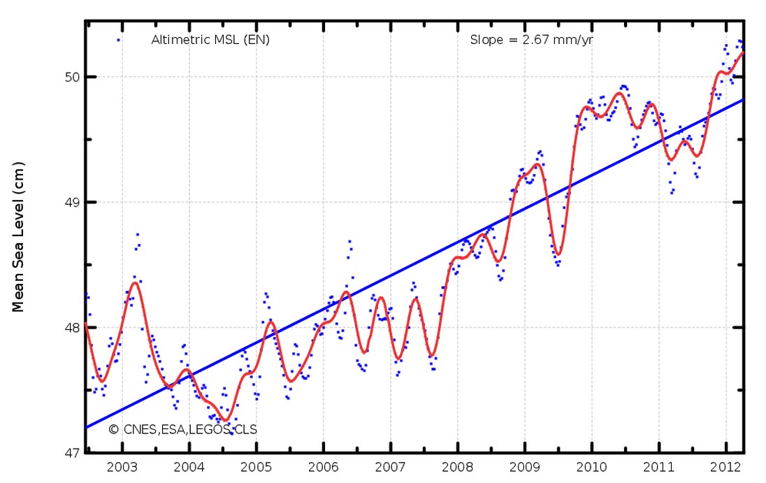
On August 4, 2011 – The European Space Agency’s Envisat satellite showed less than one mm/year sea level rise, comparable to tide gauges.
A few months later the same data set showed almost triple that rate.
A few weeks later they killed the uncooperative satellite.


They had to make an example of it, lest Jason 3 get impermissible ideas.
What happened to the uncooperative satellite?
http://youtu.be/wPo_2FPDM-0
With your data mining help, I did some work *this* year, namely transferring all of Phys.orh traffic over to WUWT:
Alinsky should be proud! I isolated it, polarized it….
Exhibit A: http://www.alexa.com/siteinfo/physorg.com
Exhibit B: http://www.alexa.com/siteinfo/wattsupwiththat.com
One time, I killed Greenfyre’s blog, permanently, with an old school Tim Leary quote or two. Are you in the war or are you just an attention whore?
I’m not in a war. Truth will always win out in the end.
Odysseus angered the gods by believing that he was in control.
It’s not control I promote, but release from divisive tribalism.
These people need a religion, and global warming is their religion. Facts never dissuade religious people.
Are you sane?
The current pre-industrial revolution trend is 19cm per century.
Warmists *need* sea rises to be significantly faster than that.
I note that nautical charts have yet to be updated with all these new depths we must be experiencing.
Reblogged this on CACA.