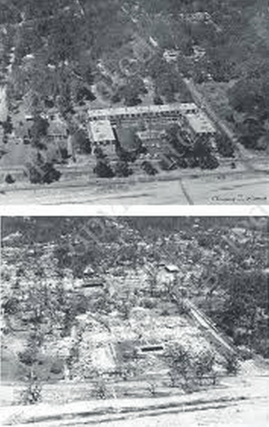
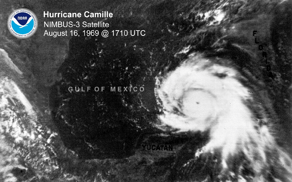
Shortly after the first moon landing, Hurricane Camille devastated the Gulf Coast with sustained winds in excess of 190 MPH. This apartment complex disappeared during the storm.
This photo was taken by one of the satellites which Arctic scientists pretend didn’t exist prior to 1979


nice catch 🙂
That bad girl dropped 27 inches of rain in about three hours in Nelson County, VA. By the time all that water reached Richmond, it was 35 feet over flood stage.
That was a few years before my tenure there, but it was (along with Agnes) the reason for the flood wall. Which since then has been used once. To keep Gaston rain IN.
The law of unintended consequences.
Thank you! Another factoid for my quiver.
What is the supposed legitimate reason for not using pre-1979 satellite data?
For ice measurements…not ‘complete’, daily coverage. But I think it’s more like they only had visible light images, on clear days of most of that time…which showed low ice extents and growing through the 70s.
The record ‘officially’ starts in Jan of ’79, but there’s at least a couple of months of full data for 1978. The Nov 78- Oct 79 looks like the ‘peak’ period….
The Labor Day hurricane of 1935 was the strongest hurricane landing in American history, during the hot 1930s decade when atmospheric CO2 was alarmingly low.
Yeah, I’ve harped about the Arctic ice starting point being 1979 several times the past few weeks. They love to use 1979-2000, 22 seasons of Arctic ice. So ‘science’ is based on a cherry picked 22 seasons of Arctic ice.
Here’s another interesting story about Camille and Katrina. Camille was a somewhat smaller storm than Katrina. There was a boat washed ashore in Camille’s storm surge. That boat was visible from US 90/98 for many years. Katrina’s surge washed that boat away.
You noted that wiped out apartment complex. What’s not generally discussed is that the old Jefferson Davis retirement home, Beauvoir, received greater damage from the weaker Katrina (which was moving north-northeastward as it crossed the eastern tip of Louisiana, all but wiping out Waveland and Pass Christian, MS, which is near to the point where that boat washed in) than it did from the stronger, but smaller, Camille; which was moving north-northwestward.
The land that complex was on later became a shopping center, which in turn was washed away by Katrina’s storm surge.
Didn’t someone recently downwardly “adjust” Camille wind speed data, similar to cooling the past and warming the present?
Glimpses of sea ice past (1964)
http://nsidc.org/monthlyhighlights/2013/04/glimpses-of-sea-ice-past/
FYI . . . that was the Richelieu Manor Apartments in Pass Christian, Mississippi, that was vanished by Camille. There is a lot of lore about the incident. Some might find an internet search interesting.