Remembering Another Prophet From August

ScreenHunter_551 Sep. 13 20.50

August 27, 2013 at 7:27 pm

Posted in Uncategorized | 9 Comments

Boulder Prophet Speaks Out About Arctic Ice

ScreenHunter_547 Sep. 13 20.17

“The overall trend is downward, and it will continue to do so,” Mark Serreze was quoted saying. Serreze is director of the National Snow and Ice Data Center.

Madcap: Deniers latch onto larger ice sheet | Politics Blog | The Bellingham Herald

Gaia told him the future, no doubt. Unfortunately the permanent drought knocked their website offline.

Posted in Uncategorized | 21 Comments

A Few Of The Recent 1,000 Year Biblical Floods Along The Front Range

In case you needed any more evidence about just how completely full of shit NOAA is.

1997 Spring Creek Flood – Fort Collins

ScreenHunter_543 Sep. 13 19.30

The storm dropped 10 inches of rain on the Quail Hollow area of Fort Collins in less than six hours. It was the most rainfall ever measured in an urban area in Colorado for that amount of time, Doesken said.

The Coloradoan – www.coloradoan.com – Ft. Collins, CO.

1976 Big Thompson River Flood

ScreenHunter_544 Sep. 13 19.35 

On July 31, 1976, during the celebration of Colorado’s centennial, the Big Thompson Canyon was the site of a devastating flash flood that swept down the steep and narrow canyon, claiming the lives of 143 people, 5 of whom were never found. This flood was triggered by a nearly stationary thunderstorm near the upper section of the canyon that dumped 300 millimeters (12 inches) of rain in less than 4 hours (more than 3/4 of the average annual rainfall for the area). Little rain fell over the lower section of the canyon, where many of the victims were. Around 9 p.m., a wall of water more than 6 meters (20 ft) high raced down the canyon at about 6 m/s (14 mph), destroying 400 cars, 418 houses and 52 businesses and washing out most of U.S. Route 34.[5] This flood was more than 4 times as strong as any in the 112-year record available in 1976, with a discharge of 1,000 cubic meters per second (35,000 ft³/s).

Big Thompson River – Wikipedia, the free encyclopedia

ScreenHunter_546 Sep. 13 19.47

The Big Thompson flood of 1976 was the deadliest flash flood in Colorado’s recorded history. On July 31, between 12 and 14 inches of rain fell over a four-hour period in the mountains around the resort town of Estes Park. Unusual weather patterns allowed the huge storm system to stall over the area as it dumped its load

1921 Pueblo flood

ScreenHunter_63 Apr. 21 14.14ScreenHunter_62 Apr. 21 14.13

Article – Untitled Article

As the torrential rains fell, the Arkansas River and Fountain Creek quickly began to swell, reaching over 15 feet in some areas before they began to recede. Within two hours from the start of the storm, the entire wholesale district and a greater part of the business district of Pueblo were flooded with water 10 feet deep. The entire Arkansas Valley, from 30 miles west of Pueblo to the Colorado–Kansas state line, was severely impacted. Hundreds of people died, with some death toll estimates as high as 1,500. The flood destroyed almost all of the downtown Pueblo area and decimated the city.

This Month in Climate History: June 3, 1921 Colorado Flooding | National Climatic Data Center (NCDC)

The rainfall intensity of the storms listed above was much greater than this week’s rain.

The NOAA liars who are claiming the current flood is a “biblical 1,000 year flood” should be prosecuted. They are shouting fire in a crowded theatre.

Posted in Uncategorized | 42 Comments

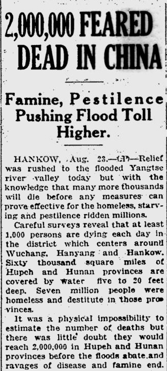
1931 : Two Million Dead In 60,000 Square Mile Flood

CO2 was 310 PPM at the time.

 Below350.org

 Below350.org

http://news.google.com/newspapers

And now we have morons blaming garden variety floods in Colorado on CO2.

Posted in Uncategorized | 3 Comments

Drudge At It Again

ScreenHunter_542 Sep. 13 17.34

The image below is the current view of Boulder Creek outside the Boulder library. Note the happy face in the sand, and the people enjoying watching the water on the foot bridge.

ScreenHunter_541 Sep. 13 17.33

Boulder Creek Camera

Does this look like a place destroyed by a wall of water?

Posted in Uncategorized | 8 Comments

Why Does Boulder Have Boulders?

Some of my fondest memories of the kids when they were small, was them playing on the boulders in Boulder Creek outside the Boulder library

ScreenHunter_540 Sep. 13 17.22

How did those massive rounded rocks get there? Countless floods over the eons have come down the canyon out of the mountains, with a force strong enough to move 1,000 lb rocks.

It blows me away to see climate morons claiming that flooding in Boulder is due to man-made CO2. They are stupider than the witch burners in The Holy Grail.

Posted in Uncategorized | 4 Comments

Shock News : Obama Lied About Being A Supporter Of Coal

Last autumn, Obama was worried that he would lose Ohio and Pennsylvania. So he lied to the people of those states, and then stabbed them in the back right after the election. (The 104% vote for Obama in Philadelphia helped too.)

ruining the atmosphere is too high a price for protecting one type of power when others are available.

Bloomberg News to US coal industry: Knuckle under to Obama climate rules or ‘die’ | JunkScience.com

At some point, voters need to stop staring into the headlights – and start using their brains.

Posted in Uncategorized | 9 Comments

100 New Green Jobs For Colorado

Oil industry manufacturer to hire 100 in Loveland

LOVELAND — A company capitalizing on the oil and gas industry boom is looking for 100 new workers, soon, for its Loveland facility.

Brighton-based Leed Fabrication Services, which opened a production facility in east Loveland last year, is quadrupling its building at 5100 N. Boyd Lake Ave. and beefing up its staff.

The company has set a job fair for Sept. 25.

Oil industry manufacturer to hire 100 in Loveland – Longmont Times-Call

This will partially offset the hundreds of Colorado jobs lost when Denver Democratic scum convinced Magpul to move their operations to a state not run by communists.

Posted in Uncategorized | 3 Comments

New Mexico Permanent Drought Update

Five weeks ago, the morons at the LA Times warned that New Mexico would never recover from the drought.

As an extended drought bakes the West, nowhere are ravages of changes in the climate worse than in New Mexico.

Aug. 6, 2013

But nowhere is it worse than in New Mexico. In this parched state, the question is no longer how much worse it can get but whether it will ever get better — and, ominously, whether collapsing ecosystems can recover even if it does.

Chuck Jones, a senior meteorologist with the National Weather Service in Albuquerque, said even the state’s recent above-average monsoon rains “won’t make a dent” in the drought; deficits will require several years of normal rainfall to erase, should normal rain ever arrive.

In New Mexico, water levels in the once-mighty Rio Grande are so low that it is often referred to as the “Rio Sand.” In some parts of the state, officials fear ecosystems are collapsing.

New Mexico is the driest of the dry – latimes.com

And five weeks later, New Mexico is flooding

ScreenHunter_538 Sep. 13 15.10

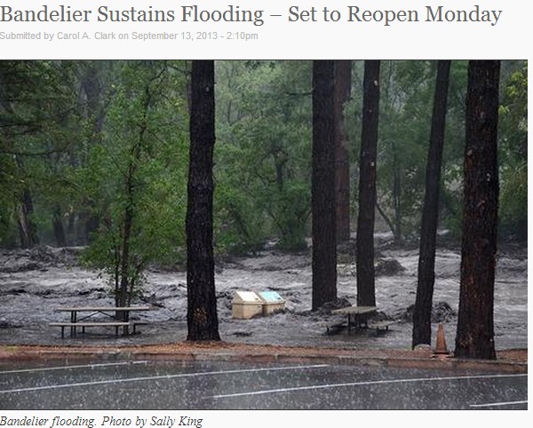
Bandelier National Monument experienced two large flood events, one late afternoon Thursday, Sept. 12 and the other this morning.

Flooding in Frijoles Canyon prompted Superintendent Jason Lott to close the monument for the safety of visitors due to debris on trails and the potential for flooding throughout the weekend.  Bandelier staff will begin clean-up efforts as soon as rains subside and hope to re-open the monument by Monday, Sept. 16.

Los Alamos Daily Post | Your locally owned community news source…

  • State Parks Temporary Closures:  Morphy Lake, Coyote Creek, Brantley Lake, Elephant Butte Lake main boat ramp.  Open with possible debris issues:  Santa Rosa Lake (risen 20 feet in last 48 hours), Sumner Lake (+ 24 feet last 48 hours), Conchas Lake (+ 5 feet last 24 hours).  Other temporary closures possible as necessary.  (3:51 p.m.)
  • Rio Grande is at 8 feet, 1 foot below flood stage at Otowi between Pojoaque and Los Alamo, National Weather Service reported just before 3 p.m.  Also warning people to stay away from the river from San Felipe downstream through Bernalillo County as flood surge expected.  (3:30 p.m.)
  • West Road in Los Alamos is CLOSED.  All other roads in Los Alamos County are open. Los Alamos County crews will continue to deal with all flooding and road issues by priority. NMDOT also has crews on site to clear any rock fall on Main Hill Road. Please be patient as we work through the issues and avoid travel if possible.

KASA – Rains cause evacuations, flooding in NM

Is there no way to shut these climate nincompoops up?

Posted in Uncategorized | 10 Comments

The Emperor’s New Flood Gauge

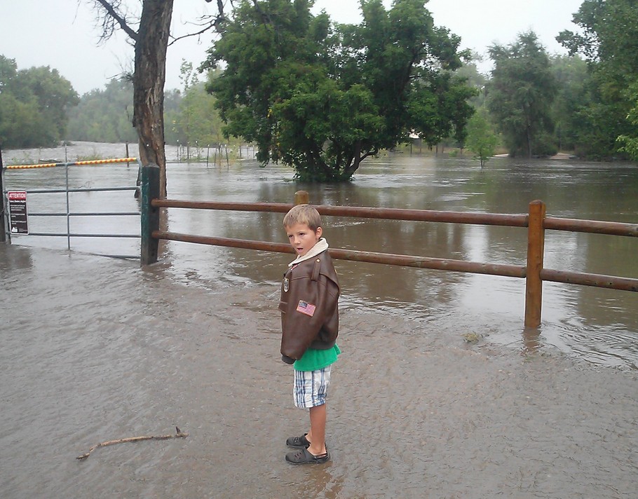
There must be federal money to be had in a big flood, because the flood information being released by the City of Fort Collins is utter nonsense.

According to the National Weather Service, the Poudre reached 14.56 feet — nearly seven times its average during the previous four days — at 8:15 a.m. Friday. At that peak, more than 420,000 gallons of water passed a stream gauge every second.

City officials says that the Poudre’s flow through the city has decreased to less than 9,000 cubic feet per second — or about 67,000 gallons per second. The city hasn’t used Poudre River water in its drinking water system since Sept. 6, and advises people not to play in or drink untreated flood water.

North Fort Collins shelter to open at 3 p.m. as bridges remain closed | The Coloradoan | coloradoan.com

According to the city, the flow is down 85% since the peak.

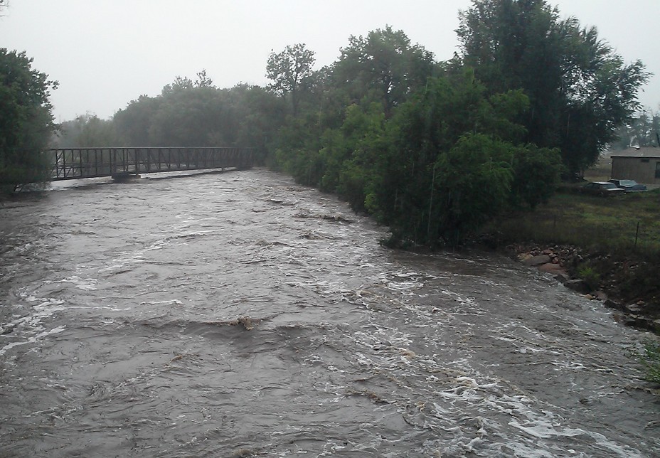
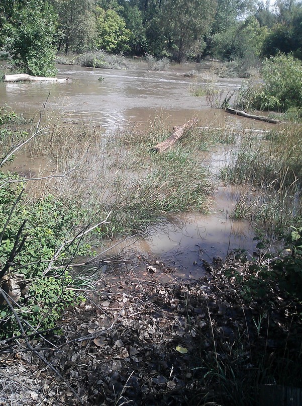
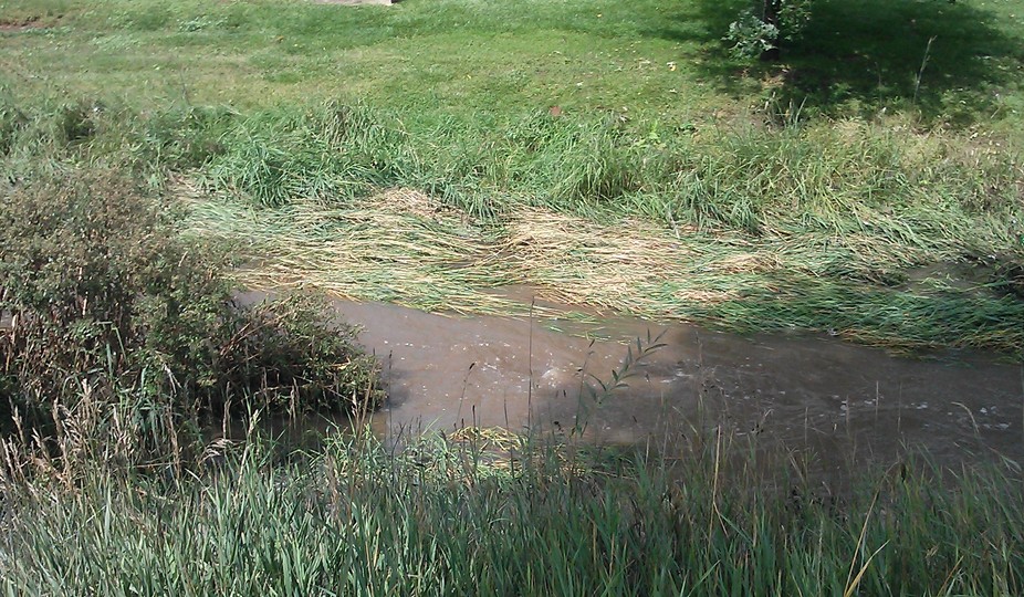
I surveyed and photographed most of the Poudre’s 15 mile path through Fort Collins today, and there is no evidence that water was ever more than a few inches higher than it is now. No mud, no debris, no foliage damage more than a few inches above the current water line.

ScreenHunter_537 Sep. 13 14.57 ScreenHunter_536 Sep. 13 14.56

This next photo shows mud several inches above the current water line.

ScreenHunter_529 Sep. 13 10.12

The next photo is of a different drainage – Spring Creek. It is obvious that the high water mark was a couple of feet higher than the current level, but there is no similar evidence on the Poudre.

ScreenHunter_535 Sep. 13 14.56

The city’s claims about the Poudre are either due to instrumentation error, or somebody is making stuff up. The flood was nowhere near as big as the city is claiming.

Posted in Uncategorized | 9 Comments