Tide gauges show that sea level in Manhattan is rising about 4mm per year and accelerating.
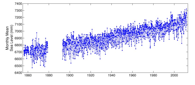
Data and Station Information for NEW YORK ( THE BATTERY)
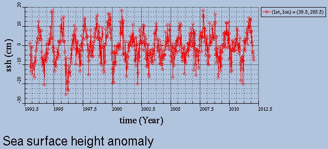
But satellite data shows little sea level rise at that same location, and has been flat since 1998.
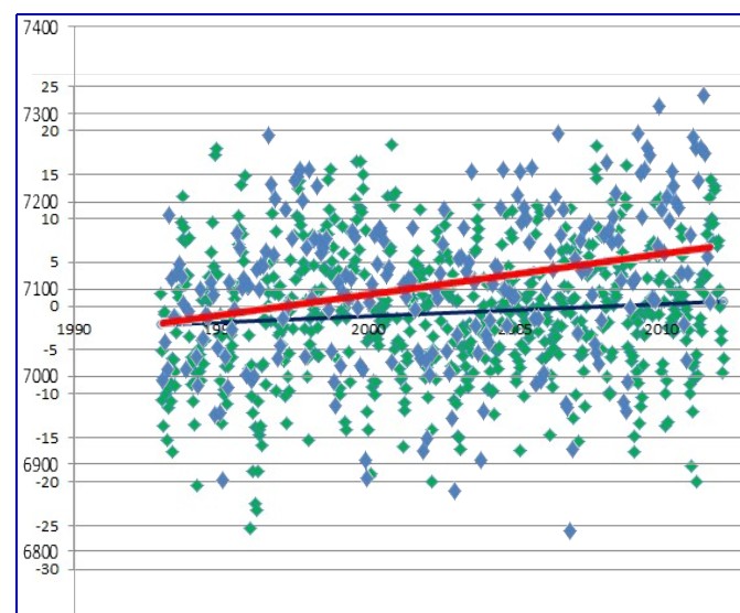
The graph below superimposes the data from the two graphs above. Essentially all of the claimed “sea level rise” (red line) is actually subsidence.
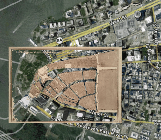
The map below superimposes lower Manhattan in 1660 on modern day lower Manhattan. Most of the land in modern lower Manhattan is fill dirt. The tide gauge is locate on fill and is subsiding.
Global warming geniuses in government tell us that we can stop subsidence by buying a hybrid or imposing a tax.