The Al-Gore-rhythm they use for the models that provide the latest extrapolated surface temperatures results makes historic temperatures flexible rather than consistent as would be seen in world measurements. It is not only GISS as the pracitce goes back to the GHCN and USHCN from which other groups get their starting data to be interpreted by each groups “Independent” Method!
Considering all these datasets require some type of “homogenization” before the results are shown, I figured there was manipulation from the start. The raw data somehow isn’t accurate because it shows there was no warming? Amazing, the duplicity.

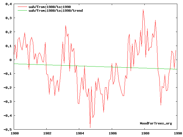
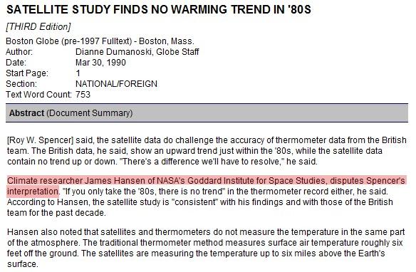


Steve can you whip up a current giss graph and highlight the 1980-90 section. Lets see if Jimmy has been playing with his numbers.
In fact i just did it at woodfor, GISS shows a rise of 0.05Deg
The Al-Gore-rhythm they use for the models that provide the latest extrapolated surface temperatures results makes historic temperatures flexible rather than consistent as would be seen in world measurements. It is not only GISS as the pracitce goes back to the GHCN and USHCN from which other groups get their starting data to be interpreted by each groups “Independent” Method!
Considering all these datasets require some type of “homogenization” before the results are shown, I figured there was manipulation from the start. The raw data somehow isn’t accurate because it shows there was no warming? Amazing, the duplicity.
Now if only NASA will work on that pesky DJIA graph and hide those declines. Save us Jimmy!!!