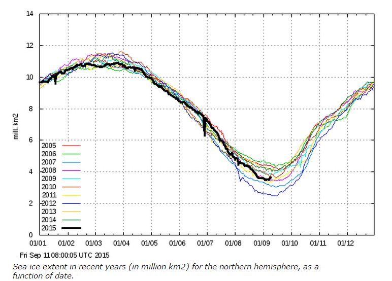
The Arctic is rapidly gaining ice now, in what appears to be the shortest melt season on record – just over five months.
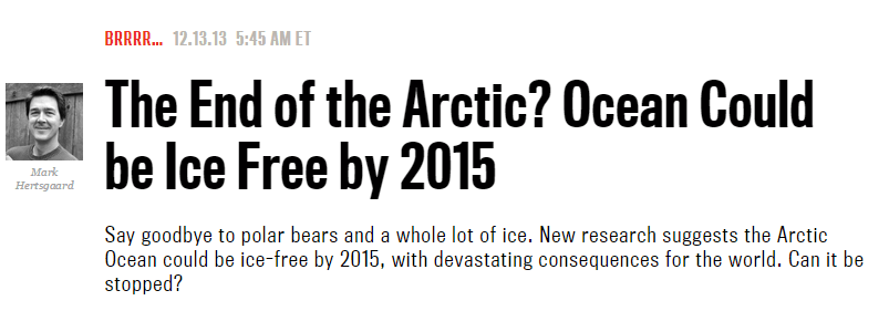
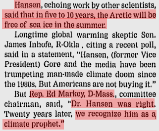
Experts say the Arctic is ice-free.
The End of the Arctic? Ocean Could be Ice Free by 2015 – The Daily Beast
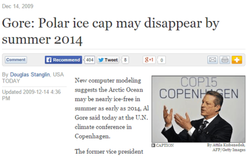
Gore: Polar ice cap may disappear by summer 2014
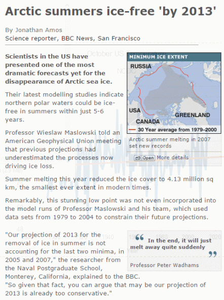
BBC NEWS | Science/Nature | Arctic summers ice-free ‘by 2013?
Why Arctic sea ice will vanish in 2013 | Sierra Club Canada
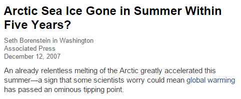
Arctic Sea Ice Gone in Summer Within Five Years?



Queue the trolls!
Please, please, please let them be back under their bridges today.
Hey Dave, it’s Friday. They won’t be wasting their employers time until Monday!
During the next Ice Age they will be predicting that the poor glaciers covering much of North America are melting.
Heck, the CAGW crowd might even claim that THEY, themselves are melting! https://www.youtube.com/watch?v=GPO43kCh3_c
Note the Dorothy at the top of this blog! She MELTED the Wicked Witch of the West!!!!
She is evil! How dare she do this!!! 🙂
Ha! Good point about Dorothy! I think, though, that Tony identifies more closely with Toto, who is also at the top of the blog. After all, it was Toto who pulled the curtain back and showed everyone how the wizard was working!
And that ice covers extending well into the Midwest represents the optimal environmental conditions for human civilization.
Ice at the North Pole in 1958 and 1959 – not so thick
26 04 2009
What would NSIDC and our media make of a photo like this if released by the NAVY today? Would we see headlines like “NORTH POLE NOW OPEN WATER”? Or maybe “Global warming melts North Pole”? Perhaps we would. sensationalism is all the rage these days. If it melts it makes headlines.
Skate (SSN-578), surfaced at the North Pole, 17 March 1959. Image from NAVSOURCE
Some additional captures from the newsreel below show that the ice was pretty thin then, thin enough to assign deckhands to chip it off after surfacing.The newsreel is interesting, here is the transcript.
1958 Newsreel: USS Skate, Nuclear Sub, Is First to Surface at North Pole
ED HERLIHY, reporting:
USS Skate heads north on another epic cruise into the strange underseas realm first opened up by our nuclear submarines. Last year, the Skate and her sister-sub Nautilus both cruised under the Arctic ice to the Pole. Then, conditions were most favorable. The Skate’s job is to see if it can be done when the Arctic winter is at its worst, with high winds pushing the floes into motion and the ice as thick as twenty-five feet.
Ten times she is able to surface. Once, at the North Pole, where crewmen performed a mission of sentiment, scattering the ashes of polar explorer Sir Hubert Wilkins. In 1931, he was the first to attempt a submarine cruise to the Pole. Now, the Skate’s twelve-day three thousand mile voyage under the ice, shown in Defense Department films, demonstrates that missile-carrying nuclear subs could lurk under the Polar Ice Cap, safe from attack, to emerge at will, and fire off H-bomb missiles to any target on Earth.
A powerful, retaliatory weapon for America’s defense
_________________________________________
I don’t know how to get the picture in the comment?
right click the picture. Select “copy image location” from the drop down menu. Go to location in document where you want the picture to be located. Right click. Select “paste” and left click.
https://wattsupwiththat.files.wordpress.com/2009/04/uss-skate-open-water.jpg
here you go…
Had an “internet argument” the other day with three lunatics that insisted sea ice freezes at -4 degrees F. They spelled out Fahrenheit and everything too, even provided references (to fully saturated salt water). They insisted that the north polar ice continues to melt at 0 deg F.
We live in a modern Middle Ages, among a generation of ignorant, uneducated people, where Burn the Witch could become Reality TV. We will be lucky as a society to endure.
They are clueless. Sea ice freezes in the winter at -2C, and melts in the summer at 0C. That is because the ice loses its salinity over time. Explorers drink melted sea ice.
Yes I quoted that to them right off the NSIDC website only to be called names.
Fundamentally, the internet is no more than a drawer full of sharp knives and loaded guns, into which ignorant children routinely reach for reference and knowledge.
Psalmon, I’m afraid I’m responsible for their beliefs. I told them about wilderness water, tough ice and other strange phenomena in governmental physics. My excuse is that I was drinking. I don’t know what’s theirs.
https://stevengoddard.wordpress.com/2014/12/15/bbc-changes-their-story-slightly
https://stevengoddard.wordpress.com/2014/12/23/climate-genius-of-the-day-2
https://stevengoddard.wordpress.com/2015/08/31/obama-is-the-44th-president-to-experience-alaskan-glacier-melting
That difference in salinity and other mineral content is what makes those pretty pastel blue strata seen in some ice bergs. They really can be wonderful works of art.
Excuse me if I’m a bit flappy. Have been up for 20 hours and driven a hard 662 mi round trip. One of the things I hate about this on call job is that when I really start getting into something, like the exchange yesterday with the trolls and especially with some new thoughtful posters I have not seen before, I always seem to get the call to go or I have to go get sleep because I know I’m going later.
rah, get an airplane; cut your travel time to a few hours! 😉
I would if there was an airline that would take 41,000 lbs of carry on! Besides that I would still need my 53′ semi trailer to get it to the plant from the airport Then I would have to get the empty racks and stuff that I hauled back. So right now I would be very happy if there was less construction and fewer A-holes on the roads. But my work week is over so it’s Jack Daniels and Coke time.
Loads hauled this week: 43,000 lbs of Nestles liquid Coffee creamer of various flavors in bottles.
.31,000 lbs of Monroe Shocks & Struts for automobiles.
8 large rolls of paper (8′ high standing on end x 3′ diameter). Each roll over 5,000 lbs. Loaded 4 over the drive axles of the tractor and 4 over the trailer tandems standing on end placed on asphalt non slip mats and secured with heavy corrugated cardboard and a strap holding each set of four together but not attached to the trailer. 42,000 lbs. (I’d rather haul Class I explosives than those big unstable rolls of paper). You drive real easy with that kind of load. Not a job for a rookie.
41,000 lbs of automobile exhaust parts.
27,000 lbs of empty parts racks and tubs.
Approx miles driven: 2,300.
” (to fully saturated salt water). ”
Yes but sea water is about 1/9 -1/10 fully saturated.. DOH !!!!!
But as we have seen recently.. the average climate hanger-on is not very bright…
…. in fact, they seem to be some of the dumbest twits we are ever likely to see.
The minimum was a little lower than we had hoped, probably due to alarmist data tampering, but with all the multi year ice around, there is very little to fear next year.
Winter storms in August broke up ice in Beaufort Sea.
Thanks Steve.
But because the ice is broken and slushy, wouldn’t it refreeze rather quickly?
Will the sea ice level shoot up steeply… time will tell 🙂
i would prefer as much open water as possible for as long as possible. what little heat is there will then be radiated to space until freeze over occurs.
it looks as though there has been a current shift possibly to do with the atlantic cooling that will hopefully open some big cracks above 80 degrees north allowing more heat loss for longer during the winter.
also looking at the northwest pacific it appears the blob is finally dissipating ,so cooling on both sides of the arctic may well be good for ice growth this winter.
All right, the damn science is so obvious and the short cycled warmist thinking is so very bad, that I simply get angry.
How did these people get into such positions of authority???
So many indices are showing what has been happening. The AMO (Atlantic Multidecacal Oscillation is showing many signs of beginning to flip to its cool phase. It is driven by the Atlantic Meridonal Overturn circulation which drives warm surface water northward and deeper cold water southward. —Notice the warmist excitement heretofore for the Arctic warming and nothing except baloney about the Antarctic?
Measurements of water flow, change in water temperature at various locations and changes in tide gauge measurements are all beginning to show evidence of the change.
The flip into the cool phase probably will not become too evident until sometime in the twenties, but who knows when.
Van Oldenberg has perhaps the most up to date graph showing the history of the Atlantic Oscillations. .
And one more thing, The Polar Bears are having a celebration in hopes of the change, and we are all invited, especially if we come on foot with no guns. (OK, I might be lying, maybe it is that I am getting influenced by Obama and Hillary),
Darrylb,
One of these days your sense of humor will get you into trouble.
No self-respecting polar bear would bite into Obama or Hillary. UGH !
The events of September 11, 2001 and Climategate emails that surfaced in late November 2009 guided me back to uncover unreported events in Konan, Korea on August-September 1945:
https://www.researchgate.net/publication/281017812_STALIN'S_SCIENCE
If you are not member of ResearchGate, you can read a synopsis here:
https://brittius.wordpress.com/2015/08/16/dr-o-manuel-ph-d-stalins-science/
Stephen, what day was the Max Ice extent this year?
Actually….I think I might be responsible for the ice loss since 1979….let me explain. In 1979, I worked in the High Arctic. In the fall, we went out onto the fjords and found bergs with the clear vein of ice in them. We hacked that out, and took it back to the station to use in our drinks. We all know that “correlation is causation” /….sarc
So THAT was the ice loss that pushed up past the tipping point and into the death spiral!
🙂
You should be tried as an environmental terrorist in the Hague!
Hague, you should be tried as an environmental terrorist !
http://heresycorner.blogspot.com/2010/09/william-hague-eco-warrior.html
😀
We have a strong magnetic storms despite the low solar activity. Earth’s magnetosphere is combined with the magnetic field of the solar wind.
http://www.n3kl.org/sun/images/noaa_satenv_half.gif?
http://www.n3kl.org/sun/images/noaa_xrays_half.gif?
I was just kinda wondering, with all the talk about the North Pole/Arctic. How many that claim to have good knowledge of such things actually even know what declination is? What LARS stands for?
I do not know what the acronym LARS represents.
declination is used to find a location
When I was in the military and then we used compasses, grid north had a certain angular difference to magnetic north
In astronomy, the declination is the angle in the celestial sky between the vertical and the physical point on the earth,
Maybe that is a sloppy response. The declination at the equator is 0 degrees, and positive 90 degrees at the north pole and negative 90 at the south pole.
Combining the declination angle with hour (time) gives a point in the sky.
LARS= Left Add Right Subtract. Using declination to determine “true” north from magnetic north. https://search.yahoo.com/yhs/search?ei=UTF-8&type=avastbcl&hspart=avast&hsimp=yhs-001&p=Declination
Declination is the angular value of how much magnetic north varies from true north at a given location on the earths surface as generally measured in degrees but for super accuracy is also done in mils. Converting between “true” or “grid” north and magnetic north is a necessary function for dead reckoning navigation using a map in order to properly orient the map and to accurately plot a course.
Remember this? https://s.yimg.com/fz/api/res/1.2/LbgAC81hd0uzjr_D4VMWrg–/YXBwaWQ9c3JjaGRkO2g9MzQ4O3E9OTU7dz0zNDg-/http://www.traditioncreek.com/storefront/images/products_supplies/map_protractor.gif
That protractor, a map, a compass, a good pace count, and a knowledge of how to read the map and identify identify terrain features is all one needs to navigate cross country on land on most places on the earth. In some mountainous regions an altimeter will also help especially if you need to pin point your location withing a few square meters.
But on nearly featureless terrain such a true desert or on bodies of water from which the shore cannot be seen then celestial navigation is the only way to go. That is IF you don’t have a GPS receiver of course.
And that has been something that has been worrying me for some time. Are our military people still being trained to do those things in this age of GPS. It seems to be that damned well better be because of the potential for the GPS network to be taken out by either man or nature/ ole sol.
Ok rah— yes, we did it that way (LARS)
However, I think the declination being referred might be to find a point in the celestial night sky, and that was used for ocean navigation.
Also, remember there was land Nav in the Southern Hemisphere
I guess I should have said “magnetic declination”. That would have made it much clearer. Sorry. The way I put it wasn’t really fair.
BTW I found this explanation that is a pretty good one: http://southwestguidebooks.com/maps/maps_ch4.htm
rah — I will have to ask someone now serving if they still instruct as they once did
in land nav.
Moving 10 or 15 km (clicks) at night with only your map and a red flashlight is an experience I would like to instruct all young people to do.
The SF Qualification course has the toughest land nav course of all. We had excellent instruction but still lots of guys failed and were recycled or sent back to their units.
Must find a total of 6 points out of 8 possible. Four possible during the day and then four more possible at night and there were other points out there that were not being used for that particular test that did not count. Trainee had two chances and that second night a whole lot of them got on the truck to be taken back to Ft. Bragg to either await recycle or to be sent back to their units because they had failed twice. Out of the 201 of us that started Phase I of the SFQC it was the land nav that took the most that didn’t make it. There were 98 of us that got through that initial course.
Distance between points varied from 2 Km to 8 Km. Done alone. They give you the 10 digit grid coordinate of each point and it’s up to you from there. Limited time. Trainee must be back to the start/finish by a certain time or none of it counts.
Instructors hiding out on the course and if they caught any trainee on a road or even a fire break trail or breaking tactical discipline with a light or by being noisy they were out of the course. At night the instructors were using NVDs to see us.
A point was metal fence stake. The top six inches painted white. Attached to the top was a stamp which punched at particular pattern of holes in a card the trainee carried. Stamping your card proved you were there. Each point was located on a particular terrain feature.
After all these years I still have a scar on my forearm where a “wait a minute” vine got me good when I was passing through a very dense patch while doing that course my first night. I didn’t get it done the first day/night. But the second day/night I did.
To make it more interesting when our class was doing the course it was deer season and there were deer hunters all over the place.
rah—Those were the good old days
I forgot to mention that in addition to a map and red flashlight, one needs a compass
Some old feelings– always had to be on the side of a hill, because –you know Charlie
In woods with a thick canopy it always seemed like you were walking into a tunnel
Once in the states, leading a squad, I went through downfall from a tornado. That, of course did not show up on the map. Could not see a thing and the downfall was taller than us. Told the pace counter to forget it. We would have to do a resection to determine where we were when got out of it.
Only did stuff like that in Country.
But in the end that knowledge of navigation and the woodscraft one learns that goes along with it all is a gift. I have no doubt, despite not doing any orienteering for more than a decade now, I could still do it and I bet you could too!
https://sunshinehours.files.wordpress.com/2015/09/arctic_sea_ice_extent_zoomed_2015_day_253_1981-2010.png
Will be great fun if the red line climbs rapidly to above the yellow and mustard lines, then up into the grey shaded area…. like I suspect it will.
Even more fun if its well into the grey by December. 🙂
Remember that that according to the Climate Alarmist’s calendar, by October we must all forget about sea ice extent because the ice begins GROWING again as it always does without fail, year after year (shhhhhh – don’t say anything!). After all, in the Alarmist’s universe, sea ice only melts – it never refreezes. In any case, by October we should have lots of global warming hurricanes to talk about…erm…umm…right???
Actually SG, not sure it is the shortest..
SunshineHours does a nice tabulation
https://sunshinehours.wordpress.com/
Extent calculations are very subjective and done differently by different groups. It appears to be the shortest.on the DMI graph.
,
Certainly among the shortest 🙂
but, but , extent does not matter, it is volume that counts and it is still in decline http://psc.apl.uw.edu/wordpress/wp-content/uploads/schweiger/ice_volume/BPIOMASIceVolumeAnomalyCurrentV2.1.png
oops ! 😉
Arctic Sea Ice Volume Model from the University of Washington (Note: this is only updated monthly, and is a model output, not a real-time observation,……enough said. 100% correlation between the model and the effects of rams bladders in the prevention of earthquakes.
agreed, but even this alarmist model is showing a marked increase in volume since 2012.
Reblogged this on Climate Collections.