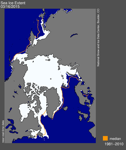
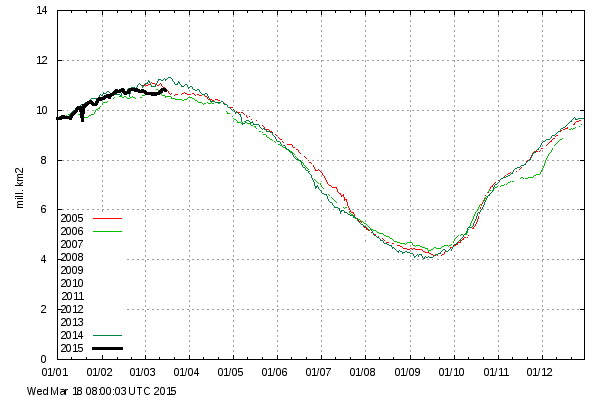
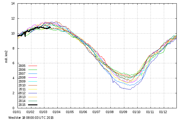
Sea ice is above normal on the Atlantic side, with a large excess in Baffin Bay and around Newfoundland. The only deficiency is in the Sea of Okhotsk, which is just north of Japan and is not in the Arctic
Joe Bastardi posted this earlier, showing how the water in the North Atlantic has turned cold.
Arctic sea ice has returned to stable 2005/2006 conditions. The Death Spiral is dead.
Look for the usual liars to continue hyping the “record low winter maximum” for as long as they can get away with it. All that an increase in ice extent this time of year means is that the ice is getting spread thinner by the wind.


Does anyone else hate the ridiculous color scheme on the water temp map?
If you look at that Bastardi image, it’s interesting to see the color representations for positive and negative anomalies. The positive goes quickly to a dark, angry red at +3 degrees. The negative starts going blue and then switches to green which then gets lighter before it hits -3. Which one sticks out more do you think?
http://igloo.atmos.uiuc.edu/cgi-bin/test/testimage.2.sh?first=20140316.jpg&second=20150316.jpg
I don’t know about this analysis of sea-ice extent. Cooks Inlet seems to be in a rare situation that it is full of sea ice. According to the NOAA
http://pafc.arh.noaa.gov/data/ice/cookice.png
most of it is sea-ice free. I was about to point out that the unusually high amount of sea ice in the inlet and massive snow falls and low temperatures in the east, yet USA had its coldest winter ever?
NOAA is saying Warmist EVAH!
Who are you going to believe? Them or your freezing ass, er, lying eyes!