July 24, 2012
Satellites See Unprecedented Greenland Ice Sheet Surface Melt
WASHINGTON — For several days this month, Greenland’s surface ice cover melted over a larger area than at any time in more than 30 years of satellite observations. Nearly the entire ice cover of Greenland, from its thin, low-lying coastal edges to its 2-mile-thick center, experienced some degree of melting at its surface, according to measurements from three independent satellites analyzed by NASA and university scientists.On average in the summer, about half of the surface of Greenland’s ice sheet naturally melts. At high elevations, most of that melt water quickly refreezes in place. Near the coast, some of the melt water is retained by the ice sheet and the rest is lost to the ocean. But this year the extent of ice melting at or near the surface jumped dramatically. According to satellite data, an estimated 97 percent of the ice sheet surface thawed at some point in mid-July.
NASA – Satellites See Unprecedented Greenland Ice Sheet Surface Melt
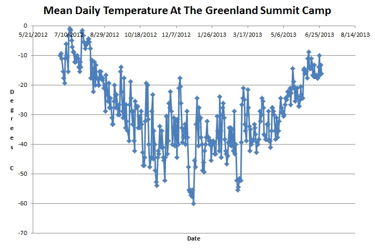
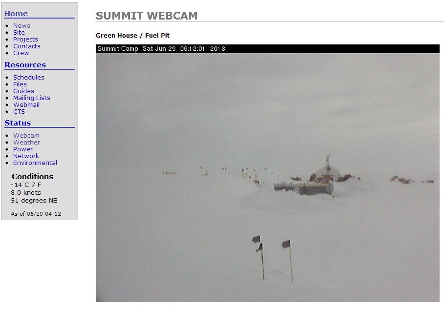
According to NASA, 47% of the ice sheet melted unnaturally last summer. There is only one weather station on the ice sheet, and it had no days last summer which averaged above freezing.
At the bottom of the article, NASA casually mentioned that whatever they claimed was unnaturally happening, actually occurs about once every 150 years.
“Ice cores from Summit show that melting events of this type occur about once every 150 years on average. With the last one happening in 1889, this event is right on time,” says Lora Koenig, a Goddard glaciologist and a member of the research team analyzing the satellite data.