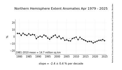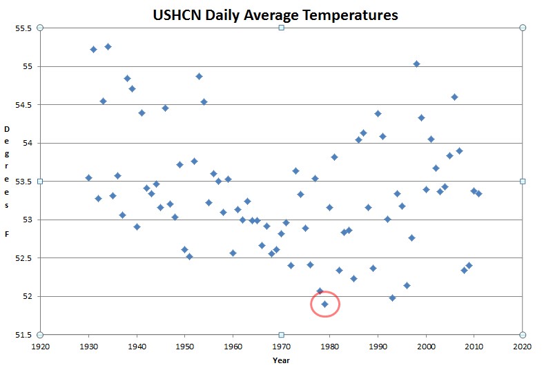
A number of key climate related satellites went into service in 1979, which coincidentally was the coldest year since the 1920s in the US (according to USHCN raw data) and also the year of peak Arctic ice. This has caused satellite temperature and Arctic ice trends to be unrepresentative of the long term patterns, and allowed them to be used as propaganda. It also occurred shortly before the eruptions of El Chichon and Mt. Pinatubo, which further dragged temperatures down.
Further aggravating the problem is that NSIDC chooses to not report satellite data prior to 1979, which inconveniently shows that there was a lot less Arctic ice in 1974 than there was in 1979.
NSIDC shows this :
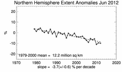
but they don’t show what happened during the five years prior to 1979.
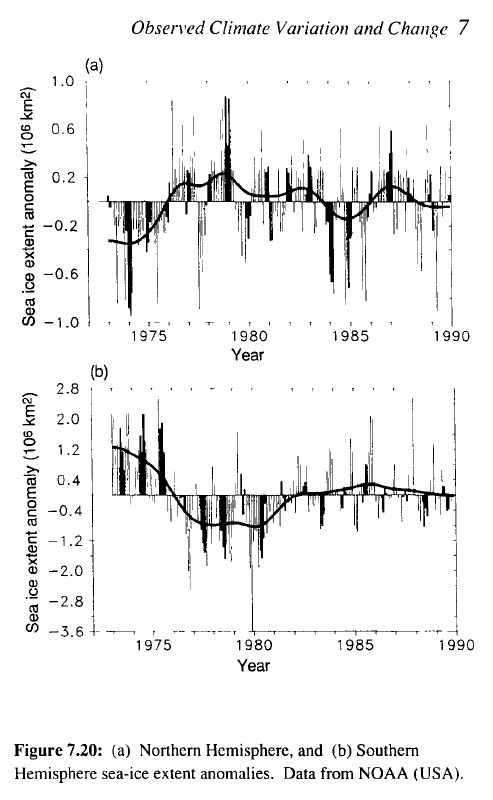
www.ipcc.ch/ipccreports/far/wg_I/ipcc_far_wg_I_full_report.pdf
Satellites are a useful tool, but it would be nice to have an honest discussion about the severe limitations of the data set.