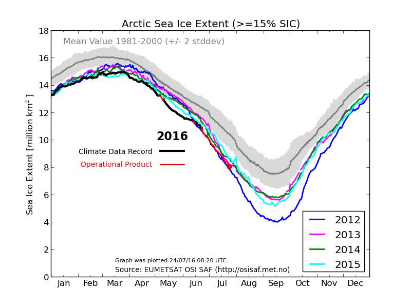
I don’t normally make longer term Arctic ice forecasts, but some things going on this year are compelling. DMI shows ice extent dropping rapidly and just above 2012.
Ocean and Ice Services | Danmarks Meteorologiske Institut
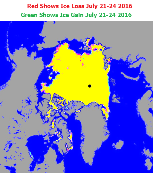
The maps which they are derived from show little ice loss over the last few days.
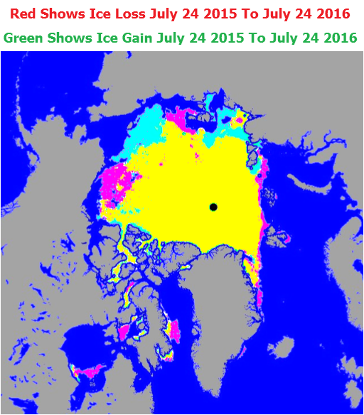
The map below shows the differences from the same date last year. Note that last year’s advantage was mainly due to ice in the Beaufort Sea, Southern Arctic and Eastern Arctic, but this year there is a lot more ice in the Chukchi and East Siberian Seas.
Last year’s advantage was an illusion. The ice in the Beaufort Sea last year was very diffuse and disappeared in a storm during the second week in August. The southern and eastern ice also melted a few days later.
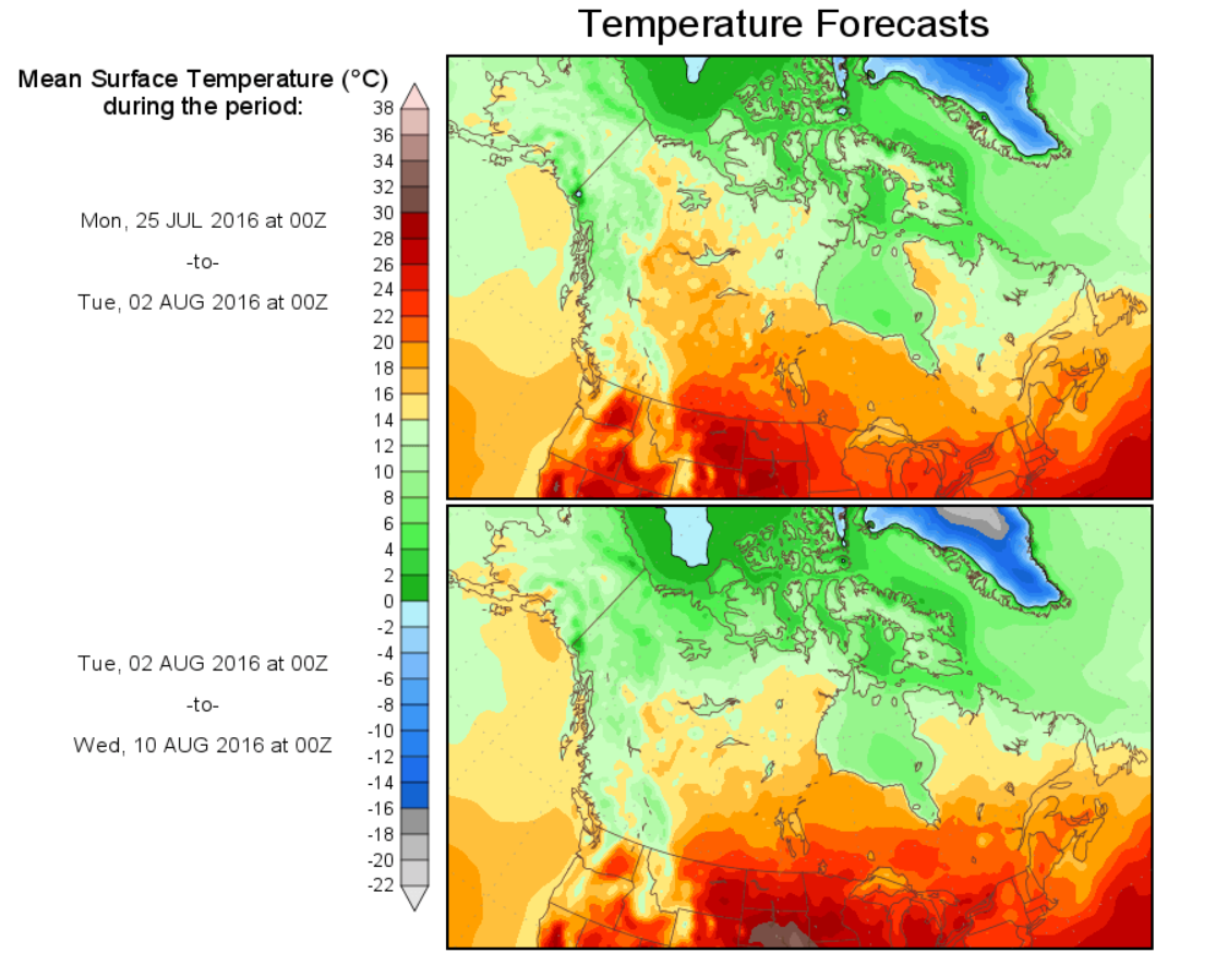
If the skies remain cloudy over the East Siberian Sea, 2016 should end up with more ice than last year, because there is much more ice this year on the Russian side. The weather is forecast to remain cold over the Beaufort Sea, so there should be minimal ice loss there too.
If my prediction is correct, alarmists are in trouble – because next year will become the first year in a decade where there is a significant amount of multi-year ice on the Russian side.


