Warmer and wetter: Maps reveal how global warming could lead to warmers and wetter temperatures across America
Maps were created to show how temperatures has changed since 1970 in all US regions
Since 1970, the average winter temperature in the continental U.S. has warmed by 2.4°
Findings come amid prediction that 2014 is likely to be warmest on record
Maps reveal how global warming will affect winter temperatures across America | Daily Mail Online
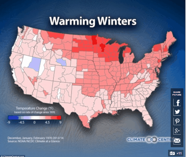
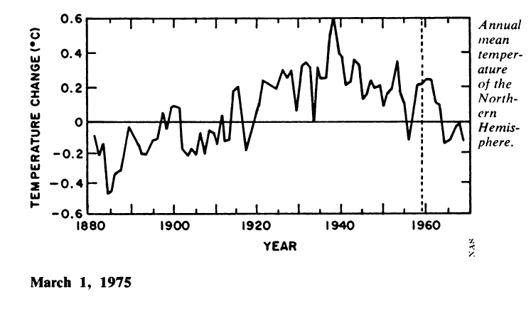
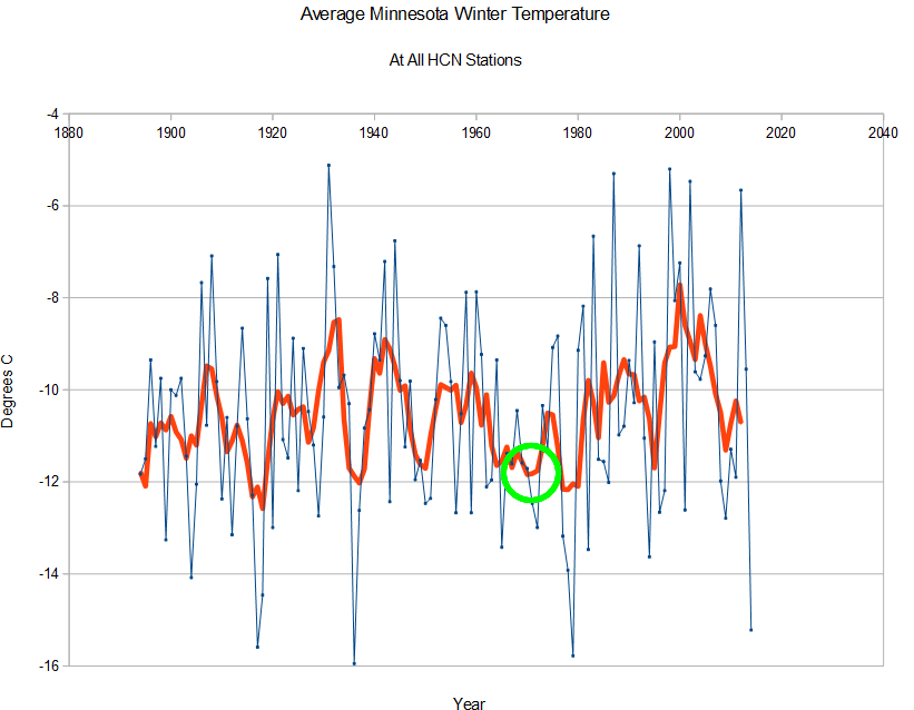
Heidi shows peak warming in Minnesota since 1970. Besides the fact that the warming numbers Climate Central used are completely fraudulent, Heidi cherry-picked one of the coldest periods on record to start her analysis. Last winter was the 4th coldest on record in Minnesota, and Lake Superior blew away their record for springtime ice.
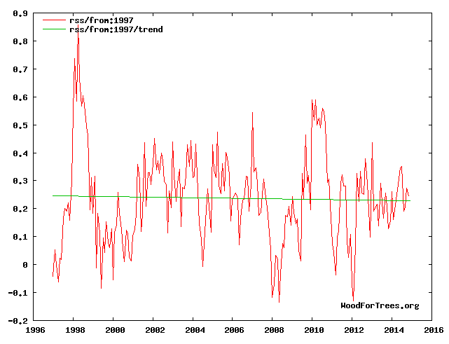
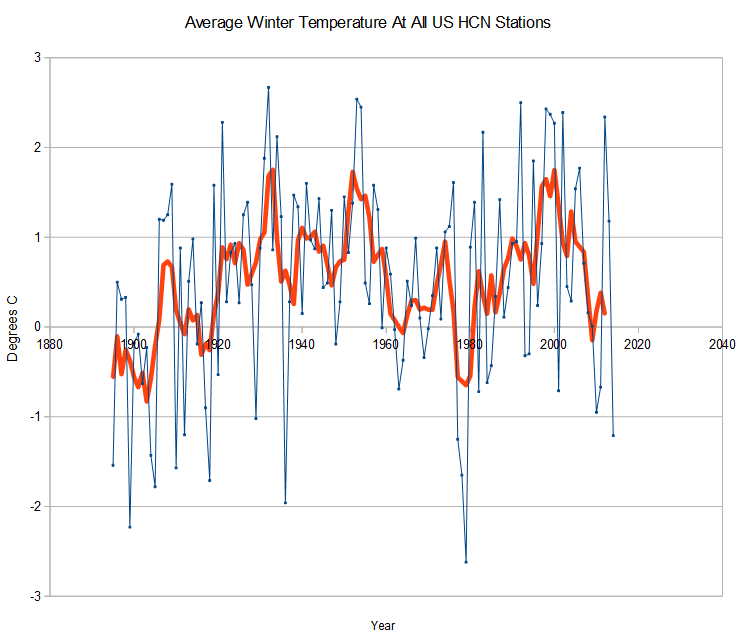
For the US as a whole, winter temperatures have been plummeting for 15 years, and are no warmer than 1970. Starting a trend line at the bottom of a cyclical function is malfeasance.
Winter snow coverage has been increasing in North America, due to the snow line pushing further south – due to cold air. The past decade has seen the furthest south snow line on record.
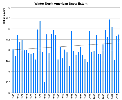
Rutgers University Climate Lab :: Global Snow Lab
Heidi and Climate Central are defrauding the public with their intentionally deceptive maps and analyses. Winter temperatures in the US are plummeting, not increasing.