Chicken Little comes home to roost – at the chopping block.
http://wxmaps.org/pix/temp2.html
Don’t you think that this is a more relevant map?
http://data.giss.nasa.gov/cgi-bin/gistemp/do_nmap.py?year_last=2011&month_last=06&sat=4&sst=1&type=anoms&mean_gen=06&year1=2011&year2=2011&base1=1951&base2=1980&radius=1200&pol=reg
And please don’t complain about the 1200 km2 smoothing because what’s sauce for the goose is sauce for the gander. Which means that your irrelevant map is also based on the same temperature stations and smoothed similarly.
OMG – one of my favorite topics!
Try making the same map with 250 km smoothing. GISS has no data in the high Arctic. They pull those red patches out of their asses.
You totally avoided a clear statement. Here it is again:
“…your irrelevant map is also based on the same temperature stations and smoothed similarly.
No I’m going to pose that statement in the form of a question.
Why do you complain about smoothing when you are obviously using a map that uses smoothing?
Inquirying minds would like to know.
Smoothing no data is a uniquely dishonest concept.
Why are you avoiding the question of why YOU are using the map at the top of this thread which also uses smoothing?
Are you as dimwitted as you pretend to be?
Your email address will not be published. Required fields are marked *
Comment *
Name *
Email *
Website
Save my name, email, and website in this browser for the next time I comment.

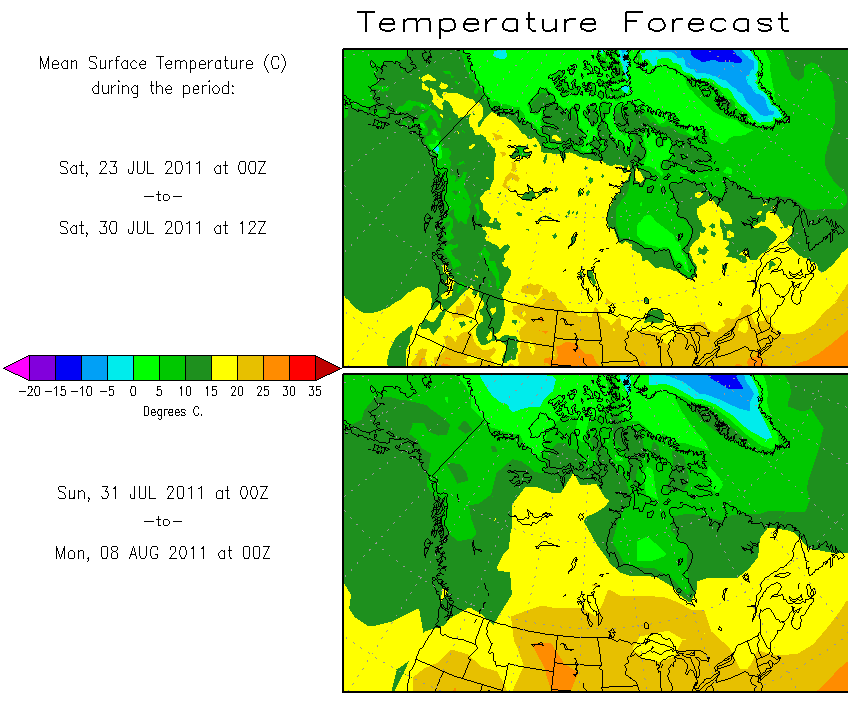


Don’t you think that this is a more relevant map?
http://data.giss.nasa.gov/cgi-bin/gistemp/do_nmap.py?year_last=2011&month_last=06&sat=4&sst=1&type=anoms&mean_gen=06&year1=2011&year2=2011&base1=1951&base2=1980&radius=1200&pol=reg
And please don’t complain about the 1200 km2 smoothing because what’s sauce for the goose is sauce for the gander. Which means that your irrelevant map is also based on the same temperature stations and smoothed similarly.
OMG – one of my favorite topics!
Try making the same map with 250 km smoothing. GISS has no data in the high Arctic. They pull those red patches out of their asses.
You totally avoided a clear statement. Here it is again:
“…your irrelevant map is also based on the same temperature stations and smoothed similarly.
No I’m going to pose that statement in the form of a question.
Why do you complain about smoothing when you are obviously using a map that uses smoothing?
Inquirying minds would like to know.
Smoothing no data is a uniquely dishonest concept.
Why are you avoiding the question of why YOU are using the map at the top of this thread which also uses smoothing?
Are you as dimwitted as you pretend to be?